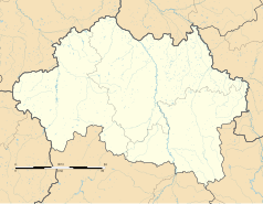
Marcenat (Allier)
| gmina | |||
 | |||
| |||
| Państwo | |||
|---|---|---|---|
| Region | |||
| Departament | |||
| Okręg | |||
| Kod INSEE | 03160 | ||
| Powierzchnia | 18,33 km² | ||
| Populacja (2015 I) • liczba ludności |
| ||
| • gęstość | 20,8 os./km² | ||
| Kod pocztowy | 03260 | ||
| Portal | |||
Marcenat – miejscowość i gmina we Francji, w regionie Owernia-Rodan-Alpy, w departamencie Allier.
Demografia
Według danych na rok 1990 gminę zamieszkiwało 330 osób, a gęstość zaludnienia wynosiła 18 osób/km². W styczniu 2015 r. Marcenat zamieszkiwało 381 osób, przy gęstości zaludnienia wynoszącej 20,8 osób/km².
Bibliografia
Media użyte na tej stronie
Autor: Flappiefh, Licencja: CC BY-SA 4.0
Blank administrative map of the department of Allier, France, for geo-location purpose.
Autor: Superbenjamin, Licencja: CC BY-SA 4.0
Blank administrative map of France for geo-location purpose, with regions and departements distinguished. Approximate scale : 1:3,000,000
Autor: Flappiefh, Licencja: CC BY-SA 4.0
Carte administrative vierge de la région Auvergne-Rhône-Alpes, France, destinée à la géolocalisation.
Autor: Chatsam, Licencja: CC BY-SA 3.0
blason de la commune de Marcenat : De gueules à la fasce ondée d’azur bordée d’argent accompagnée en chef d’une fleurs de lys d’or accostée de deux brins de muguet au naturel et en pointe d’une tête de chevreuil coupée d’or
Autor: Tabl-trai, Licencja: CC BY-SA 3.0
Town hall of Marcenat [8601]


