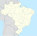
Maringá
| |||||
 | |||||
| Państwo | |||||
| Stan | |||||
| Burmistrz | Silvio Magalhães Barros II | ||||
| Powierzchnia | 487,012 km² | ||||
| Wysokość | 555 m n.p.m. | ||||
| Populacja (2021) • liczba ludności • gęstość | 436 472[1] 733,14 os./km² | ||||
| Nr kierunkowy | 44 | ||||
| Kod pocztowy | 87000-000 | ||||
| Strona internetowa | |||||
Maringá – miasto w południowej Brazylii (stan Paraná), na Wyżynie Brazylijskiej.
Liczba mieszkańców w 2021 roku wynosiła ok. 436,4 tys.
W mieście rozwinął się przemysł spożywczy[2].
Miasta partnerskie
Przypisy
- ↑ Estimativas da populaçao para 1o de julho de 2009
- ↑ Maringá, [w:] Encyklopedia PWN [online] [dostęp 2021-09-13].
Linki zewnętrzne
Media użyte na tej stronie
Autor:
- Parana_MesoMicroMunicip.svg: Raphael Lorenzeto de Abreu
- derivative work: Milenioscuro (talk)
Location map of Paraná state.
Equirectangular projection, N/S stretching 110 %. Geographic limits of the map:
- N: 22.35° S
- S: 26.78° S
- W: 54.79° W
- E: 47.90° W
Flag of Paraná, Brazil
Flag of Portugal, created by Columbano Bordalo Pinheiro (1857-1929), officially adopted by Portuguese government in June 30th 1911 (in use since about November 1910). Color shades matching the RGB values officially reccomended here. (PMS values should be used for direct ink or textile; CMYK for 4-color offset printing on paper; this is an image for screen display, RGB should be used.)
Maringá, Brasil. Foto de autoria de Pedro Aguiar, tirada em fevereiro de 2003 do alto da Catedral de Nossa Senhora da Glória.
Autor: Allice Hunter, Licencja: CC BY-SA 4.0
From left to right and top to bottom: skyline of Maringá with the Cathedral of Maringá; the Ingá Park; Grevilea Woods; Chapel of Santa Cruz de Maringá; Park of Japan.


