Market Harborough
 Grammar School | |
| Państwo | |
|---|---|
| Kraj | |
| Hrabstwo | |
| Dystrykt | |
| Populacja (2002) • liczba ludności |
|
| Nr kierunkowy | 01858 |
| Kod pocztowy | LE16 |
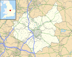
Położenie na mapie Leicestershire Contains Ordnance Survey data © Crown copyright and database right, CC BY-SA 3.0 | |
Położenie na mapie Wielkiej Brytanii (c) Karte: NordNordWest, Lizenz: Creative Commons by-sa-3.0 de | |
| Portal | |
Market Harborough – miasto w Wielkiej Brytanii, w Anglii w hrabstwie Leicestershire, w dystrykcie Harborough, położone na południu hrabstwa, nad rzeką Welland, 23 km na południe od Leicester i 16 km na północ od Kettering. Stacja kolejowa na trasie Londyn - Leeds. Miasto zamieszkuje 20 785 osób[1].
Historia
Miasto założono w drugiej połowie dwunastego wieku, głównie dla celów handlowych i taką funkcję pełniło aż do dwudziestego wieku. W średniowieczu podzielono centrum na czterdzieści osiem parcel (yards) – każda należała do innego kupca. Ślady tego podziału zachowały się aż do dziś[2].
Przypisy
- ↑ Leicestershire Population & Household Estimates for Small Areas 2001-2004 (ang.). [dostęp 2008-11-06].
- ↑ Jules Yard (ang.). [dostęp 2008-11-06]. [zarchiwizowane z tego adresu (18 września 2008)].
Media użyte na tej stronie
Contains Ordnance Survey data © Crown copyright and database right, CC BY-SA 3.0
Map of Leicestershire, UK with the following information shown:
- Administrative borders
- Coastline, lakes and rivers
- Roads and railways
- Urban areas
Equirectangular map projection on WGS 84 datum, with N/S stretched 160%
Geographic limits:
- West: 1.80W
- East: 0.50W
- North: 53.00N
- South: 52.36N
(c) Karte: NordNordWest, Lizenz: Creative Commons by-sa-3.0 de
Location map of the United Kingdom
Redirect arrow, to be used in redirected articles in Wikipedias written from left to right. Without text.
Flag of England. Saint George's cross (a red cross on a white background), used as the Flag of England, the Italian city of Genoa and various other places.
Old Grammar School, Church Square, Market Harborough, Leicestershire. The school was on the first floor; the open ground floor was a butter market. Note the pargeting between the timber framing.


