Marmolejo
| ||
 Marmolejo – drugi szczyt od prawej | ||
| Państwo | ||
| Położenie | Departamento Tunuyán↗ | |
| Pasmo | Andy | |
| Wysokość | 6108 m n.p.m. | |
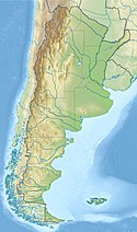
Marmolejo – wygasły stratowulkan w Andach, na granicy argentyńsko-chilijskiej. Leży zaraz obok wciąż czynnego wulkanu San José. Jest to najbardziej na południe wysunięty sześciotysięcznik na świecie.
Bibliografia
- Oscar González-Ferrán: Volcanes de Chile. Santiago, Chile: Instituto Geográfico Militar, 1995, s. 640. ISBN 956-202-054-1. (po hiszpańsku)
- John Biggar: The Andes: A Guide for Climbers (3rd ed.). Andes Publishing (Scotland), 2005, s. 304. ISBN 0-9536087-2-7.
Media użyte na tej stronie
Autor:
- Argentina_location_map.svg: NordNordWest
- Map_of_Mendoza_Province.svg: Pertile
- derivative work: Milenioscuro
Location map of Mendoza province (Argentina)
Łatwo można dodać ramkę naokoło tej grafiki
Black up-pointing triangle ▲, U+25B2 from Unicode-Block Geometric Shapes (25A0–25FF)
Autor: Pablo H z -, Licencja: CC BY 2.0
Andes, Argentina/Chile border.
DSC03524.JPG
Autor:
- Argentina_location_map.svg: NordNordWest
- derivative work: Виктор В (talk)
Location map of Argentina


