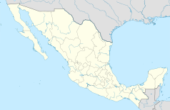
Matamoros
| |||
 | |||
| |||
| Państwo | |||
| Stan | |||
| Gmina | Matamoros | ||
| Burmistrz | Erick Silva Santos | ||
| Wysokość | 10 m n.p.m. | ||
| Populacja (2010) • liczba ludności | 449 815[1] | ||
| Nr kierunkowy | 868 | ||
| Kod pocztowy | 87300 | ||
| Strona internetowa | |||
Matamoros – miasto we wschodnim Meksyku, w stanie Tamaulipas, port nad rzeką Rio Grande, naprzeciw amerykańskiego miasta Brownsville. Około 450 tys. mieszkańców[1]. Jest siedzibą władz gminy Matamoros.
W mieście rozwinął się przemysł chemiczny, skórzany, bawełniany oraz spożywczy[2].
Miasta partnerskie
Przypisy
- ↑ a b Principales resultados por localidad 2010 (ITER) (hiszp.). Instituto Nacional de Estadística, Geografía e Informática.. [dostęp 2015-08-03].
- ↑ Matamoros, [w:] Encyklopedia PWN [online] [dostęp 2021-09-13].
Media użyte na tej stronie
The flag of Navassa Island is simply the United States flag. It does not have a "local" flag or "unofficial" flag; it is an uninhabited island. The version with a profile view was based on Flags of the World and as a fictional design has no status warranting a place on any Wiki. It was made up by a random person with no connection to the island, it has never flown on the island, and it has never received any sort of recognition or validation by any authority. The person quoted on that page has no authority to bestow a flag, "unofficial" or otherwise, on the island.
Escudo del Estado de Tamaulipas
Coat of arms of Tamaulipas
Heroica Matamoros Coat of Arms


