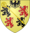
Maubeuge
| miejscowość i gmina | |||
 | |||
| |||
| Państwo | |||
|---|---|---|---|
| Region | |||
| Departament | |||
| Okręg | |||
| Kod INSEE | 59392 | ||
| Powierzchnia | 18,85 km² | ||
| Populacja (1990) • liczba ludności |
| ||
| • gęstość | 1856 os./km² | ||
| Kod pocztowy | 59600 | ||
Położenie na mapie Nord (c) Eric Gaba, Wikimedia Commons user Sting, CC BY-SA 3.0 | |||
| Portal | |||
Maubeuge – miejscowość i gmina we Francji, w regionie Hauts-de-France, w departamencie Nord.
Według danych na rok 1990 gminę zamieszkiwało 34 989 osób, a gęstość zaludnienia wynosiła 1856 osób/km² (wśród 1549 gmin regionu Nord-Pas-de-Calais Maubeuge plasuje się na 14. miejscu pod względem liczby ludności, natomiast pod względem powierzchni na miejscu 67.).
Miasta partnerskie
Bibliografia
- Francuski urząd statystyczny. (fr.).
Media użyte na tej stronie
(c) Eric Gaba, Wikimedia Commons user Sting, CC BY-SA 3.0
Blank administrative map of the department of Nord, France, for geo-location purpose, with distinct boundaries for regions, departments and arrondissements.
Autor: Superbenjamin, Licencja: CC BY-SA 4.0
Blank administrative map of France for geo-location purpose, with regions and departements distinguished. Approximate scale : 1:3,000,000
Autor: Flappiefh, Licencja: CC BY-SA 4.0
Carte administrative vierge de la région Hauts-de-France, France, destinée à la géolocalisation.
Mons's gate to Maubeuge in department Nord in France. Built under Louis XIV of France by Sébastien Le Prestre de Vauban in 1682 to shelter a guardroom, housing and cells. The door is the last one of three doors of the surrounding wall of the city. Indeed the Door of France was destroyed in 1958 the door of Bavay is destroyed in 1952. it is built brick-built, blue stone and stoneware and possesses a drawbridge. it is classified as "Historic Monument" since 1924. It is the Tourist Information Office.


