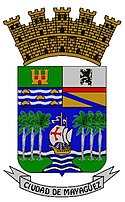
Mayagüez
| |||||
 | |||||
| Państwo | |||||
| Terytorium nieinkorporowane | |||||
| Populacja (2010) • liczba ludności | 89 000[1] | ||||
| Kod pocztowy | 00680–00682 | ||||
| Portal | |||||
Mayagüez – miasto na zachodnim wybrzeżu Portoryko, nad cieśniną Mona; założone około 1763; 89 tys. mieszkańców (2010); ośrodek hafciarstwa; eksperymentalna stacja rolnicza; port morski, połączenie kolejowe i drogowe ze stolicą terytorium San Juan oraz Ponce; ważny port lotniczy; w okolicy złoża limonitu; 1918 poważnie zniszczone wskutek trzęsienia ziemi.
W mieście rozwinął się przemysł cukrowniczy, tytoniowy oraz włókienniczy[1].
Przypisy
- ↑ a b Mayagüez, [w:] Encyklopedia PWN [online] [dostęp 2021-07-25].
Media użyte na tej stronie
The flag of Navassa Island is simply the United States flag. It does not have a "local" flag or "unofficial" flag; it is an uninhabited island. The version with a profile view was based on Flags of the World and as a fictional design has no status warranting a place on any Wiki. It was made up by a random person with no connection to the island, it has never flown on the island, and it has never received any sort of recognition or validation by any authority. The person quoted on that page has no authority to bestow a flag, "unofficial" or otherwise, on the island.
Flag of Mayagüez, Puerto Rico
Mayagüez City Hall
Autor: NordNordWest, Licencja: CC BY-SA 3.0
Location map of Puerto Rico, USA


