Methil
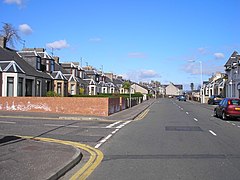
(c) Sandy Gemmill, CC BY-SA 2.0 | |
| Państwo | |
|---|---|
| Hrabstwo | |
| Populacja • liczba ludności |
|
| Nr kierunkowy | 01333 |
| Kod pocztowy | KY8 |
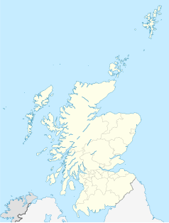
Położenie na mapie Fife Contains Ordnance Survey data © Crown copyright and database right, CC BY-SA 3.0 | |
Położenie na mapie Wielkiej Brytanii (c) Karte: NordNordWest, Lizenz: Creative Commons by-sa-3.0 de | |
Położenie na mapie Szkocji | |
| Portal | |
Methil (gael. Maothchoille) – miasto we wschodniej Szkocji, w hrabstwie Fife, położone na południowym brzegu rzeki Leven, nad jej ujściem do zatoki Firth of Forth (Morze Północne). Wraz z sąsiednimi miastami Leven i Buckhaven tworzy zwarty zespół miejski, zwany Levenmouth[1].
Przypisy
- ↑ Levenmouth. Undiscovered Scotland. [dostęp 2021-10-06]. (ang.).
Linki zewnętrzne
- Historia miasta. rpasmith.co.uk. [zarchiwizowane z tego adresu (2016-03-03)]. (ang.)
Media użyte na tej stronie
(c) Karte: NordNordWest, Lizenz: Creative Commons by-sa-3.0 de
Location map of the United Kingdom
(c) Eric Gaba, NordNordWest, CC BY-SA 3.0
Location map of Scotland, United Kingdom
Contains Ordnance Survey data © Crown copyright and database right, CC BY-SA 3.0
Blank map of Fife, UK with the following information shown:
- Administrative borders
- Coastline, lakes and rivers
- Roads and railways
- Urban areas
Equirectangular map projection on WGS 84 datum, with N/S stretched 175%
Geographic limits:
- West: 3.8W
- East: 2.5W
- North: 56.5N
- South: 55.9N
(c) Sandy Gemmill, CC BY-SA 2.0
Lower Methil High Street The view of the suburban end of the High Street at the junction with Rose Street.


