Metro w Nowym Jorku
| metro | |
Logo MTA New York City Subway | |
| Państwo | |
|---|---|
| Lokalizacja | Nowy Jork |
| Organizator | miasto Nowy Jork |
| Operator | New York City Transit Authority |
| Liczba linii | 27 |
| Lata funkcjonowania | od 1904 |
| Dzienna liczba pasażerów | 5 655 755 (2016) [1] |
| Roczna liczba pasażerów | 1 756 814 800 (2016)[1] |
| Infrastruktura | |
| Długość sieci | tras: 394 km torów: 1112 km |
| Rozstaw szyn | 1435 mm |
| Liczba stacji | 472 |
| Tabor | |
| Liczba pojazdów | 6418 (grudzień 2017) [2] |
| Strona internetowa | |
| Portal | |
Metro w Nowym Jorku (ang. New York City Subway) – system podziemnej kolei miejskiej w Nowym Jorku. Ma najwięcej na świecie stacji – 472[3], a także najwięcej na świecie linii metra – 27[4]. Ich łączna długość to 394 km[5] i 1112 km długości toru. Dziennie przewozi ok. 5,65 mln osób (2016)[6]. Jest czwartą siecią metra na świecie pod względem rocznej liczby przewożonych pasażerów (ok. 1,8 miliarda pasażerów w 2016)[7] oraz drugą najstarszą w USA (starsze jest tylko metro w Bostonie).
Metro nowojorskie jest jednym z trzech na świecie, które całodobowo są dostępne dla pasażerów. Opłaty za przejazd dokonuje się za pomocą karty MetroCard. Współpracująca z metrem nowojorskim sieć Port Authority Trans-Hudson łączy Manhattan z Jersey City, Hoboken, Harrison oraz Newark, składa się ona z 22,2 km torów.
Historia
Pierwszą linię metra w Nowym Jorku otwarto 27 października 1904 roku. Nazywała się Ninth Avenue Line i została zamknięta w 1958 (właściciel: IRT - Interborough Rapid Transit Company). Po pewnym czasie pojawił się na rynku konkurent IRT: BRT (Brooklyn Rapid Transit Company później Brooklyn-Manhattan Transit Corporation – BMT), który budował głównie metro na Brooklynie. W 1932 roku powstała pierwsza linia budowana przez miasto, a tym samym powstało jeszcze jedno przedsiębiorstwo zajmujące się metrem w Nowym Jorku: Independent Subway System (IND). W 1953 roku powstał The New York City Transit Authority, który przejął zarząd nad całą komunikacją w mieście, w tym nad metrem. Od tej pory był tylko jeden właściciel metra, dzięki czemu łatwiej jest nim podróżować (np. wcześniej nie można było przechodzić pomiędzy stacjami różnych właścicieli nie wychodząc na powierzchnię). W 1968 nad The New York City Transit Authority przejął zarząd Metropolitan Transportation Authority (MTA) i zarządza metrem do dzisiaj.
Rekordy
- 23 września 2014 pobity został rekord – od kiedy prowadzone są dobowe statystyki (1985) – dziennego przewozu pasażerów, który wyniósł ponad 6 mln pasażerów. We wrześniu 2014 z szybkiej kolei miejskiej w Nowym Jorku skorzystało blisko 150 mln ludzi, był to najwyższy wynik od ponad 60 lat[8].
Linie metra w Nowym Jorku


| Nazwa | Trasa | |
|---|---|---|
| Broadway–Seventh Avenue Local | Van Cortlandt Park–242nd Street ↔ South Ferry | |
| Seventh Avenue Express | Wakefield–241st Street ↔ Flatbush Avenue–Brooklyn College/New Lots Avenue | |
| Seventh Avenue Express | Harlem–148 Street ↔ New Lots Avenue | |
| Lexington Avenue Express | Woodlawn ↔ Crown Heights–Utica Avenue/New Lots Avenue | |
| Lexington Avenue Express | Eastchester–Dyre Avenue/Nereid Avenue ↔ Flatbush Avenue–Brooklyn College/New Lots Avenue | |
| Lexington Avenue Local Pelham Bay Park Express | Pelham Bay Park/Parkchester ↔ Brooklyn Bridge–City Hall | |
| Flushing Local Flushing Express | Flushing–Main Street ↔ 34th Street–Hudson Yards | |
| Eighth Avenue Express | Inwood–207 Street ↔ Ozone Park–Lefferts Boulevard/Far Rockaway–Mott Avenue/Rockaway Park–Beach 116th Street | |
| Sixth Avenue Express | Bedford Park Boulevard/145th Street ↔ Brighton Beach | |
| Eighth Avenue Local | 168th Street ↔ Euclid Avenue | |
| Sixth Avenue Express | Norwood–205th Street ↔ Coney Island–Stillwell Avenue | |
| Eighth Avenue Local | Jamaica Center–Parsons/Archer ↔ World Trade Center | |
| Queens Boulevard Express/Sixth Avenue Local | Jamaica–179th Street ↔ Coney Island–Stillwell Avenue | |
| Brooklyn-Queens Crosstown | Court Square ↔ Church Avenue | |
| Nassau Street Local | Jamaica Center–Parsons/Archer ↔ Broad Street | |
| 14th Street–Canarsie Local | Eighth Avenue ↔ Canarsie–Rockaway Parkway | |
| Queens Boulevard/Sixth Avenue Local | Forest Hills–71st Avenue ↔ Middle Village–Metropolitan Avenue | |
| Broadway Express | Astoria–Ditmars Boulevard/96th Street ↔ Coney Island–Stillwell Avenue | |
| Second Avenue/Broadway Express/Brighton Local | 96th Street ↔ Coney Island–Stillwell Avenue | |
| Broadway Local | Forest Hills–71st Avenue ↔ Bay Ridge–95th Street | |
| 42nd Street Shuttle | Times Square ↔ Grand Central | |
| Franklin Avenue Shuttle | Franklin Avenue ↔ Prospect Park | |
| Rockaway Park Shuttle | Broad Channel ↔ Rockaway Park–Beach 116th Street | |
| Second Avenue Local | 125th Street ↔ Hanover Square (W 2011 roku w trakcie budowy)[9] | |
| Broadway Local | Astoria–Ditmars Boulevard ↔ Whitehall Street–South Ferry | |
| Nassau Street Express | Jamaica Center–Parsons/Archer ↔ Broad Street |
Wpływ zamachów z 11 września na metro nowojorskie
Stacja Cortlandt Street na Manhattanie została czasowo zamknięta z powodu gruzów które po zawaleniu się wież zniszczyły część stacji.
Połączenia
- 60th Street Tunnel Connection (Queens)
- Chrystie Street Connection (Manhattan)
Tabor
Według stanu na grudzień 2017 metro nowojorskie dysponuje flotą 6418 wagonów metra[2]
| Oznaczenie | Lata budowy wykonawca | Zdjęcie | Numeracja | Obsługiwane linie | Stacja techniczno-postojowa |
|---|---|---|---|---|---|
| R32/R32A | 1964-1965 Budd Company |  | R32A: 3350-3649 R32: 3650-3949
|
| |
| R42 | 1969-1970 St Louis Car Company | 4550-4949
|
| ||
| R44 | 1971-1972 St Louis Car Company | 388-466
| Staten Island Railway |
| |
| R46 | 1975-1978 Pullman Company | 5482-6258
|
| ||
| R62 | 1983-1985 Kawasaki Heavy Industries |  | 1301-1625
|
| |
| R62A | 1984-1987 Bombardier Transportation |  | 1651-2475
|
| |
| R68 | 1986-1988 Westinghouse Electric Corporation, AMRail |  | 2500-2924
|
| |
| R68A | 1988-1989 Kawasaki Heavy Industries |  (c) I, Adam E. Moreira, CC BY-SA 3.0 us | 5001-5200
|
| |
| R142 | 1999-2003 Bombardier Transportation | 1101-1250, 6301-7180
|
| ||
| R142A | 1999-2004 Bombardier Transportation |  | 7211-7810
|
| |
| R143 | 2001-2003 Kawasaki Heavy Industries |  | 8101-8312
|
| |
| R160A | 2005-2010 Alstom |  | 8313-8652, 8313-8652 8653-8712, 9233-9802
|
|
|
| R160B | 2005-2010 Kawasaki Heavy Industries |  | 8713-9232, 9803-9942
|
|
Galeria metra w Nowym Jorku
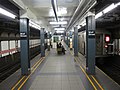
Stacja Wall Street na linii 7th Avenue (2010)
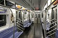
pociąg metra w Nowym Jorku od wewnątrz

pociąg metra od zewnątrz

Stacja Broad Channel

Stacja South Ferry – Whitehall Street
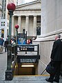
Wejście do stacji Broad Street

Wejście do stacji Times Square – 42nd Street
Wejście do stacji Roosevelt Avenue / 74th Street
Wejście do stacji 125th Street

Przypisy
- ↑ a b Introduction to Subway Ridership (ang.). MTA info. [dostęp 2018-03-04].
- ↑ a b MTA New York City Transit at a Glance (ang.). MTA info. [dostęp 2018-03-04].
- ↑ World Metro Database (ang.). mic-ro.com. [dostęp 2014-10-25].
- ↑ New York (ang.). mic-ro.com. [dostęp 2014-10-25].
- ↑ World Metro Database (ang.). mic-ro.com. [dostęp 2014-10-25].
- ↑ World Metro Database (ang.). mic-ro.com. [dostęp 2014-10-25].
- ↑ Subway and Bus Ridership (ang.). web.mta.info. [dostęp 2014-10-25].
- ↑ Subway Ridership Breaks Records (ang.). mta.info, 2014-10-22. [dostęp 2014-10-25].
- ↑ Podziemna kolej. „Świat Nauki”. nr. 8 (240), s. 50-51, sierpień 2011. Prószyński Media. ISSN 0867-6380.
Linki zewnętrzne
Media użyte na tej stronie

The flag of Navassa Island is simply the United States flag. It does not have a "local" flag or "unofficial" flag; it is an uninhabited island. The version with a profile view was based on Flags of the World and as a fictional design has no status warranting a place on any Wiki. It was made up by a random person with no connection to the island, it has never flown on the island, and it has never received any sort of recognition or validation by any authority. The person quoted on that page has no authority to bestow a flag, "unofficial" or otherwise, on the island.
Bullet for New York City Subway 4 service, used from 1979-present.
Bullet for New York City Subway R service.
Autor: Daniel Schwen, Licencja: CC-BY-SA-3.0
Broad Street Station entrance opposite of the New York Stock Exchange at the corner of Wall Street. Federal Hall in the background.

(c) Sta2GUYZ z angielskiej Wikipedii, CC BY 2.5
R44 or MUE2 rail car on the Staten Island Railway row
R44 Si or MUE2 tran car
Autor: Daniel Schwen, Licencja: CC-BY-SA-3.0
A train R44-type rolling stock at Beach 67th Street and Gaston station on the Far Rockaway branch.
Autor: Adam E. Moreira, Licencja: CC-BY-SA-3.0
D train, led by car #2590, entering Bay Parkway on the West End Line heading to Manhattan.
Bullet for New York City Subway L service.
Bullet for New York City Subway 3 service, used from 1979-present.
Bullet for New York City Subway G service.
Bullet for New York City Subway C service.
Bullet for New York City Subway A service.
Autor: Adam E. Moreira, Licencja: CC-BY-SA-3.0
A #3 train entering Sutter Avenue-Rutland Road.
Bullet for New York City Subway M service
Autor: Adam E. Moreira, Licencja: CC-BY-SA-3.0
A 6 Express train running express on the Westchester Avenue line through the St. Lawrence Avenue Station.
Bullet for New York City Subway T service.
Bullet for New York City Subway 1 service.
Bullet for New York City Subway 6 diamond service.
Bullet for New York City Subway J service.
Bullet for New York City Subway F service.
Bullet for New York City Subway Z service.
Bullet for New York City Subway 5 service.
Autor: CountZ, Licencja: CC BY-SA 3.0
New York City Subway map, late night service only
Autor: Adam E. Moreira, Licencja: CC-BY-SA-3.0
NYCTA F train 3604 entering the Avenue P subway station.
Bullet for New York City Subway Q service used from 2001-present.
Autor: Oryginalnym przesyłającym był Floflo z francuskiej Wikipedii, Licencja: CC BY-SA 2.5
A number 6 train pulling into the Grand Central–42. Street station at the Lexington Avenue Line.
Bullet for New York City Subway E service.

(c) Bebo2good1 z angielskiej Wikipedii, CC BY-SA 4.0
A 5 train leaving Gun Hill Road station, using an R142 train set
Bullet for New York City Subway 7 service, used from 1979-present.
Autor: AEMoreira042281, Licencja: CC-BY-SA-3.0
An R160B train, led by car #8888, approaches the 39 Avenue-Beebe Avenue station.
Bullet for New York City Subway B service

Autor: User:Jleon, Licencja: CC-BY-SA-3.0
A station for the elevated No. 7 line of the New York City Subway in Jackson Heights, Queens.
Bullet for New York City Subway 7 service.
(c) I, Adam E. Moreira, CC BY-SA 3.0 us
N train, led by car #5076, leaving Fort Hamilton Parkway on the West End Line. This train is here as the result of a scheduled diversion.
Autor: AEMoreira042281, Licencja: CC BY-SA 3.0
An R160A E train boards and alights customers at 42 Street-Port Authority Bus Terminal.
Bullet for New York City Subway 2 service, used from 1967-present.

(c) Error46146 z angielskiej Wikipedii, CC BY 3.0
R46 F train leaving Smith-9th Street
Autor: AEMoreira042281, Licencja: CC BY-SA 3.0
An R143 L train leaves the Broadway Junction station bound for Rockaway Parkway.
Bullet for New York City Subway D service, used from 1967-present.

Autor: Daniel Schwen, Licencja: CC-BY-SA-3.0
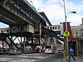
125th Street Station, with the Manhattan Valley Viaduct, part of the original IRT line.
Bullet for New York City Subway 6 service, used from 1979-present.

Autor: Daniel Schwen, Licencja: CC-BY-SA-3.0
South Ferry Station in Lower Manhattan is the end point of the New York City Subway 1 train (The 9 train, as pictured above, was discontinued in 2005). The station is located in a loop and serves as a turning point for the trains going back north. It is located near the South Ferry terminal. Due to the small size of the station only the first five cars of the stopping trains can be boarded and alighted. Retractable platforms bridge the exceptionally large gap at the traindoors caused by the sharp curvature of the track.

Autor: Gryffindor, Licencja: CC BY-SA 3.0
Wall Street (IRT Broadway – Seventh Avenue Line)

(c) CountZ z angielskiej Wikipedii, CC BY-SA 3.0
Map of the New York City Subway
Looking south at a work train on the northbound local track of IND Church Avenue station
Bullet for New York City Subway N service.
