Mettet
 | |||||
| Państwo | |||||
|---|---|---|---|---|---|
| Prowincja | |||||
| Burmistrz | Michel Remy | ||||
| Powierzchnia | 116,78 km² | ||||
| Populacja (2017[1]) • liczba ludności • gęstość |
| ||||
| Nr kierunkowy | 071 | ||||
| Kod pocztowy | 5640 | ||||
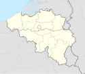
Położenie na mapie Belgii (c) Karte: NordNordWest, Lizenz: Creative Commons by-sa-3.0 de | |||||
| Strona internetowa | |||||
Mettet (wal. Metet) – miejscowość i gmina w centralnej części Belgii, w prowincji Namur. W 2017 roku Mettet zamieszkane było przez 12 975 ludzi. Znajduje się tu tor wyścigowy Circuit Jules Tacheny, noszący nazwisko urodzonego w Mettet belgijskiego kierowcy wyścigowego, Jules'a Tacheny.
W 1975 roku Mettet wspólnie z Yvoir zorganizowało 48. mistrzostwa świata w kolarstwie szosowym.
Linki zewnętrzne
Przypisy
- ↑ Stan na 1 stycznia 2017 roku, Direction générale Institutions et Population: Chiffres de la population par province et par commune, à la date du premier janvier 2017. [dostęp 2017-01-01]. (fr.).
Media użyte na tej stronie
(c) Karte: NordNordWest, Lizenz: Creative Commons by-sa-3.0 de
Location map of Belgium
Autor: Milenioscuro, Licencja: CC BY-SA 3.0
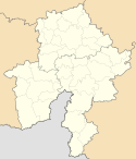
Location map of Namur province, Belgium
Pontaury, Ortsteil der Gemeinde Mettet (Belgien, Provinz Namur), Kirche des Ortsteils
Shows the flag of the province of Namur in Belgium.
Pontaury, Ortsteil der Gemeinde Mettet (Belgien, Provinz Namur), rue de Pontaury.
Flags of municipalities of Mettet, in Namur province, Belgium. Description from FOTW: The municipal flag of Mettet is quartered by a white cross green and green with a white border.


