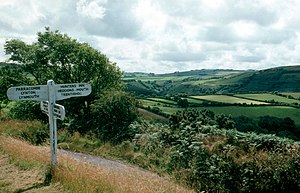
Mid Devon
| dystrykt niemetropolitalny | |
 | |
| Państwo | |
|---|---|
| Kraj | |
| Region | |
| Hrabstwo | |
| Siedziba | |
| Powierzchnia | 577,1 km² |
| Populacja (2011) • liczba ludności |
|
| • gęstość | 130 os./km² |
| Położenie na mapie hrabstwa Devon Contains Ordnance Survey data © Crown copyright and database right, CC BY-SA 3.0 | |
| Strona internetowa | |
| Portal | |
Mid Devon – dystrykt w Anglii, w hrabstwie Devon. Powstał w wyniku reformy administracyjnej w roku 1974 przez połączenie gmin Tiverton i Crediton. Do roku 1978 nosił nazwę dystryktu Tiverton. Dystrykt o powierzchni 194 km2 zamieszkuje 125 522 osób[1]. Dystrykt znajduje się częściowo na terenie parku narodowego Exmoor. Centrum administracyjnym dystryktu jest Tiverton.
Miasta
Inne miejscowości
Appledore, Bickleigh, Black Dog, Bow, Brushford, Burlescombe, Butterleigh, Cadbury, Cadeleigh, Chawleigh, Cheriton Bishop, Cheriton Fitzpaine, Clannaborough, Clayhanger, Clayhidon, Coldridge, Colebrooke, Copplestone, Crediton Hamlets, Cruwys Morchard, Culmstock, Down St Mary, Eggesford, Halberton, Hemyock, Hittisleigh, Hockworthy, Holcombe Rogus, Huntsham, Kennerleigh, Kentisbeare, Lapford, Loxbeare, Morchard Bishop, Morebath, Newton St Cyres, Nymet Rowland, Oakford, Poughill, Puddington, Sampford Peverell, Sandford, Shillingford, Shobrooke, Silverton, Stockleigh English, Stockleigh Pomeroy, Stoodleigh, Templeton, Thelbridge, Thorverton, Uffculme, Uplowman, Upton Hellions, Washfield, Washford Pyne, Wembworthy, Willand, Woolfardisworthy, Yeoford, Zeal Monachorum.
Przypisy
Media użyte na tej stronie
Flag of England. Saint George's cross (a red cross on a white background), used as the Flag of England, the Italian city of Genoa and various other places.
Autor: Manfred Heyde, Licencja: CC BY-SA 3.0
Exmoor landscape in North Devon, Great Britain
Contains Ordnance Survey data © Crown copyright and database right, CC BY-SA 3.0
Equirectangular map projection on WGS 84 datum, with N/S stretched 150%


