Mill en Sint Hubert
| |||||
 Kościół w Mill | |||||
| |||||
| Państwo | |||||
| Prowincja | |||||
| Burmistrz | Antoine Walraven (2014)[1] | ||||
| Powierzchnia | 53,17 km² | ||||
| Populacja (2014) • liczba ludności • gęstość | 10 843 [2] 207 os./km² | ||||
| Nr kierunkowy | 0815 | ||||
| Kod pocztowy | 5450-5455 | ||||
| Strona internetowa | |||||
Mill en Sint Hubert – gmina w prowincji Brabancja Północna w Holandii. W 2014 roku liczyła sobie 10 843 mieszkańców.
Stolicą gminy jest miasteczko Mill (6050 mieszk.). Pozostałe miejscowości gminy to Langenboom (2280), Sint Hubert (1570) i Wilbertoord (1120).
W Mill znajduje się kościół Sint-Willebrorduskerk, który został poświęcony w 1881 roku. W 1939 roku dodano dwa nowe skrzydła mimo ubóstwa miejscowej ludności. Prócz tego w gminie położony jest wiatrak Beltmolen.
Przypisy
- ↑ gemeente-mill.nl: College van B&W (niderl.). [dostęp 2014-07-14]. [zarchiwizowane z tego adresu (2014-01-17)].
- ↑ Aktualna liczba mieszkańców miasta (nl) [dostęp 17 kwietnia 2014]
Media użyte na tej stronie
Autor: Erik Frohne, Licencja: CC BY-SA 3.0
Location map of province North Brabant in the Netherlands
Equirectangular projection, N/S stretching 161 %. Geographic limits of the map:
- N: 51.90° N
- S: 51.20° N
- W: 4.10° E
- E: 6.10° E
Vlag gemeente Mill en Sint Hubert
(c) Hdekroon, CC-BY-SA-3.0
Beltmolen De Duif te Nunspeet (Foto: Hans de Kroon)
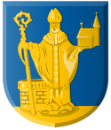
Coat of arms of Mill_en_Sint_Hubert, Netherlands.
To jest zdjęcie holenderskiego zabytku (rijksmonument) numer 29932


