Miraumont
| gmina | |||
 | |||
| |||
| Państwo | |||
|---|---|---|---|
| Region | |||
| Departament | |||
| Okręg | |||
| Kod INSEE | 80549[1] | ||
| Powierzchnia | 13,96 km²[2] | ||
| Populacja (2011) • liczba ludności |
| ||
| • gęstość | 50 os./km² | ||
| Kod pocztowy | 80300 | ||
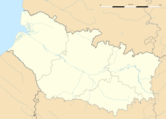
Położenie na mapie Sommy (c) Eric Gaba, Wikimedia Commons user Sting, CC BY-SA 3.0 | |||
| Portal | |||
Miraumont – francuska gmina i miejscowość w regionie Hauts-de-France w departamencie Somma.
Populacja gminy wynosi 696 mieszkańców (2011), powierzchnia – 13,96 km², gęstość zaludnienia – 50 osób na km²[3].
Historia
Miraumont było teatrem bitwy pod Bapaume w czasie wojny francusko-pruskiej.
Burmistrzem Miraumont jest René Delattre.
Geografia
Miejscowość jest usytuowana na skrzyżowaniu dróg D107 oraz D50. Miraumont znajduje się około 27 kilometrów od miasta Amiens.
Populacja
| 1962 | 1968 | 1975 | 1982 | 1990 | 1999 | 2006 | 2011 |
|---|---|---|---|---|---|---|---|
| 676 | 680 | 671 | 695 | 632 | 655 | 698 | 696 |
Przypisy
- ↑ Kod INSEE na stronie francuskiego urzędu statystycznego (fr.)
- ↑ Statystyki na stronie francuskiego urzędu statystycznego (fr.)
- ↑ Populacja na stronie francuskiego urzędu statystycznego (fr.)
Media użyte na tej stronie
(c) Eric Gaba, Wikimedia Commons user Sting, CC BY-SA 3.0
Blank administrative map of the department of Somme, France, as in December 2014, for geo-location purpose, with distinct boundaries for regions, departments and arrondissements.
Autor: Superbenjamin, Licencja: CC BY-SA 4.0
Blank administrative map of France for geo-location purpose, with regions and departements distinguished. Approximate scale : 1:3,000,000
Autor: Flappiefh, Licencja: CC BY-SA 4.0
Carte administrative vierge de la région Hauts-de-France, France, destinée à la géolocalisation.
Autor: Chatsam, Licencja: CC BY-SA 3.0
blason de la commune
D'argent à trois tourteaux de gueules.La gare de Miraumont, sur la ligne de ligne de Paris à Lille, au début des années 1900.


