Miyoshi (Aichi)
| |||||||
 | |||||||
| Państwo | |||||||
|---|---|---|---|---|---|---|---|
| Prefektura | |||||||
| Wyspa | |||||||
| Region | |||||||
| Burmistrz | Kenji Onoda (od 08.12.2013) | ||||||
| Powierzchnia | 32,19 km² | ||||||
| Populacja (2015.10.01) • liczba ludności • gęstość |
| ||||||
| Nr kierunkowy | 0561 | ||||||
| Kod pocztowy | 470-0295 | ||||||
| Symbole japońskie | |||||||
| Drzewo | |||||||
| Kwiat | Rhododendron indicum | ||||||
| Strona internetowa | |||||||
| Portal | |||||||
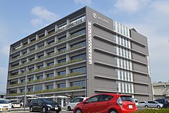
Miyoshi (jap. みよし市 Miyoshi-shi) – miasto w Japonii, w prefekturze Aichi, na wyspie Honsiu.
1 kwietnia 1958 roku wioska Miyoshi (jap. 三好村) z powiatu Nishikamo zdobyła status miasteczka. Miyoshi zdobyło status miasta 4 stycznia 2010 roku, wraz z tą zmianą nazwa miasta została zmieniona z zapisu w kanji (三好) na hiraganę (みよし)[1][2].
Edukacja
- Tōkai Gakuen University
Populacja
Zmiany w populacji Miyoshi w latach 1970–2015:
| Rok | Populacja |
|---|---|
| 1970 | 19 734 |
| 1975 | 25 303 |
| 1980 | 28 552 |
| 1985 | 30 039 |
| 1990 | 32 241 |
| 1995 | 39 920 |
| 2000 | 47 684 |
| 2005 | 56 252 |
| 2010 | 60 099 |
| 2015 | 61 810 |
Miasta siostrzane
 Stany Zjednoczone: Columbus (Indiana) (od 16 lutego 1995)
 Japonia: Shibetsu (od 6 października 2000)
 Japonia: miasteczko Kiso (Nagano) (od 14 października 1983)
Przypisy
- ↑ みよし市(し)ってどんなところ?. city.aichi-miyoshi.lg.jp. [dostęp 2017-05-01]. (jap.).
- ↑ 平成21年第2回三好町議会定例会. city.aichi-miyoshi.lg.jp. [dostęp 2017-05-01]. (jap.).
Linki zewnętrzne
- Oficjalna strona miasta (jap.)
Media użyte na tej stronie
The flag of Navassa Island is simply the United States flag. It does not have a "local" flag or "unofficial" flag; it is an uninhabited island. The version with a profile view was based on Flags of the World and as a fictional design has no status warranting a place on any Wiki. It was made up by a random person with no connection to the island, it has never flown on the island, and it has never received any sort of recognition or validation by any authority. The person quoted on that page has no authority to bestow a flag, "unofficial" or otherwise, on the island.
Autor: Created by LERK, Licencja: Copyrighted free use
The shadow picture of Aichi Prefecture, Japan
Autor: Maximilian Dörrbecker (Chumwa), Licencja: CC BY-SA 3.0
Location map of Japan
Equirectangular projection.
Geographic limits to locate objects in the main map with the main islands:
- N: 45°51'37" N (45.86°N)
- S: 30°01'13" N (30.02°N)
- W: 128°14'24" E (128.24°E)
- E: 149°16'13" E (149.27°E)
Geographic limits to locate objects in the side map with the Ryukyu Islands:
- N: 39°32'25" N (39.54°N)
- S: 23°42'36" N (23.71°N)
- W: 110°25'49" E (110.43°E)
- E: 131°26'25" E (131.44°E)
Autor: Lincun, Licencja: CC BY-SA 3.0
Map of Aichi Prefecture, Japan.
Flag of Miyoshi, Aichi Prefecture


