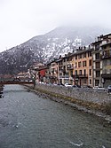
Moûtiers
| miejscowość i gmina | |||
 Moûtiers, 2005 | |||
| |||
| Państwo | |||
|---|---|---|---|
| Region | |||
| Departament | |||
| Okręg | |||
| Kod INSEE | 73181 | ||
| Powierzchnia | 3,16 km² | ||
| Populacja (2017) • liczba ludności |
| ||
| Kod pocztowy | 73600 | ||
| Portal | |||
Moûtiers – miejscowość i gmina we Francji, w regionie Owernia-Rodan-Alpy, w departamencie Sabaudia. W 2017 roku populacja gminy wynosiła 3958 mieszkańców[1]. Nazwa miejscowości wywodzi się od łacińskiego Monasterium (klasztor)[2].
W Moûtiers Doron de Bozel uchodzi do rzeki Isère[3].
Przypisy
- ↑ Populations légales 2017 (fr.). INSEE. [dostęp 2020-05-04].
- ↑ Adolphe Gros, Dictionnaire étymologique des noms de lieu de la Savoie, La Fontaine de Siloë, 2004, ISBN 978-2-84206-268-2 [dostęp 2019-10-13] (fr.).
- ↑ Atlas Routier France 2014. Michelin, 2014, s. 234. ISBN 978-2-06-719261-4. (fr.)
Bibliografia
- Francuski urząd statystyczny (fr.).
Media użyte na tej stronie
Autor: Superbenjamin, Licencja: CC BY-SA 4.0
Blank administrative map of France for geo-location purpose, with regions and departements distinguished. Approximate scale : 1:3,000,000
Autor: Flappiefh, Licencja: CC BY-SA 4.0
Carte administrative vierge de la région Auvergne-Rhône-Alpes, France, destinée à la géolocalisation.
Autor: MOSSOT, Licencja: CC BY-SA 3.0
Moûtiers - Cathédrale Saint-Pierre - Chapelle latérale nord et tour orientale
Autor: Oryginalnym przesyłającym był Pierrelm z francuskiej Wikipedii, Licencja: CC-BY-SA-3.0
L'Isère à Moûtiers (Savoie, France).
Autor: Eric Gaba (Sting - fr:Sting), Licencja: CC BY-SA 3.0
Blank administrative map of the department of Savoie, France, for geo-location purpose.
Scale : 1:800,000 (precision : 200 m)
Autor: MOSSOT, Licencja: CC BY-SA 3.0
Moûtiers - Cathédrale Saint-Pierre
Autor: Floflo, Licencja: CC BY-SA 3.0
The Savoyan commune of Moûtiers's coat of arms.
Autor: MOSSOT, Licencja: CC BY-SA 3.0
Moûtiers - Passerelle en bois sur l'Isère


