Modřany
| ||||
| ||||
 | ||||
| Państwo | ||||
| Miasto | Praga | |||
| Data założenia | 1968 | |||
| Powierzchnia | 7,71 km² | |||
| Populacja (2006) • liczba ludności | 31 738 | |||
| • gęstość | 4116 os./km² | |||
| Kod pocztowy | 143 00 | |||
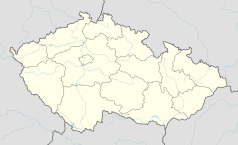
Położenie na mapie Czech (c) Karte: NordNordWest, Lizenz: Creative Commons by-sa-3.0 de | ||||
| Portal | ||||
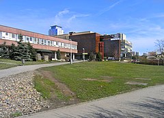
Modřany – część Pragi leżąca w dzielnicy Praga 12, na południe od centrum miasta. W 2006 zamieszkiwało ją 31 738 mieszkańców.
Kontrola autorytatywna (gmina katastralna w Czechach):
Media użyte na tej stronie
Czech Republic adm location map.svg
(c) Karte: NordNordWest, Lizenz: Creative Commons by-sa-3.0 de
Location map of the Czech Republic
(c) Karte: NordNordWest, Lizenz: Creative Commons by-sa-3.0 de
Location map of the Czech Republic
Prague CoA CZ.svg
Prague coat of arms.
Prague coat of arms.
Prague location map.png
Autor:
Map of Prague, Czech Republic
Autor:
OpenStreetMap contributors
,
Licencja: CC BY-SA 2.0
Map of Prague, Czech Republic
Prague Modrany Sofia Sq.jpg
Autor: Czech Wikipedia user Packa, Licencja: CC BY-SA 2.5
Sofia square at Modřany, Prague
Autor: Czech Wikipedia user Packa, Licencja: CC BY-SA 2.5
Sofia square at Modřany, Prague
Praha CoA CZ.svg
Prague coat of arms.
Prague coat of arms.


