Mons (Hérault)
| miejscowość i gmina | |||
 | |||
| |||
| Państwo | |||
|---|---|---|---|
| Region | |||
| Departament | |||
| Okręg | |||
| Kod INSEE | 34160 | ||
| Powierzchnia | 22,57 km² | ||
| Populacja (1990) • liczba ludności |
| ||
| • gęstość | 23 os./km² | ||
| 43°34′17″N 2°57′20″E/43,571389 2,955556 | |||
| Portal | |||
Mons – miejscowość i gmina we Francji, w regionie Oksytania, w departamencie Hérault.
Według danych na rok 1990 gminę zamieszkiwało 519 osób, a gęstość zaludnienia wynosiła 23 osoby/km² (wśród 1545 gmin Langwedocji-Roussillon Mons plasuje się na 508. miejscu pod względem liczby ludności, natomiast pod względem powierzchni na miejscu 322.).
Bibliografia
- Francuski urząd statystyczny. (fr.).
Media użyte na tej stronie
Autor: Flappiefh, Licencja: CC BY-SA 4.0
Blank administrative map of the department of Hérault, France, for geo-location purpose.
Autor: Superbenjamin, Licencja: CC BY-SA 4.0
Blank administrative map of France for geo-location purpose, with regions and departements distinguished. Approximate scale : 1:3,000,000
Autor: Flappiefh, Licencja: CC BY-SA 4.0
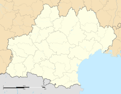
Carte administrative vierge de la région Languedoc-Roussillon-Midi-Pyrénées, France, destinée à la géolocalisation.
Autor: Christian Ferrer, Licencja: CC BY-SA 3.0
The Southern end of the Gorges d'Héric, at above on the right the Pas du Cabalet (543m), below in the foreground the Ruisseau d'Héric, in the background in the left the Jaur Valley and behind it the Mont Naudech (753m). Mons, Hérault, France. Haut-Languedoc Regional Natural Park.
Autor: Christian Ferrer, Licencja: CC BY 4.0
Mons-la-Trivalle depuis le Caroux dans le commune de Saint-Martin-de-l'Arçon. Hérault, France.


