Mont-Saint-Guibert
 | |||||
| Państwo | |||||
|---|---|---|---|---|---|
| Region | Waloński | ||||
| Burmistrz | Jean-François Breuer | ||||
| Powierzchnia | 18,63 km² | ||||
| Populacja (2017[1]) • liczba ludności • gęstość | 7440 399 os./km² | ||||
| Nr kierunkowy | 010 | ||||
| Kod pocztowy | 1435 | ||||
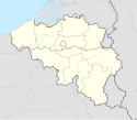
Położenie na mapie Belgii (c) Karte: NordNordWest, Lizenz: Creative Commons by-sa-3.0 de | |||||
| Strona internetowa | |||||
Mont-Saint-Guibert – miejscowość i gmina położona w belgijskiej prowincji Brabancja Walońska. Nazwa miejscowości pochodzi od imienia św. Wiberta (Gwiberta)[2].
Przypisy
- ↑ Stan na 1 stycznia 2017 roku, Direction générale Institutions et Population: Chiffres de la population par province et par commune, à la date du premier janvier 2017 (fr.). [dostęp 2017-01-01].
- ↑ Longnon A., Les noms de lieu de la France; leur origine, leur signification, leurs transformations, Paryż 1973, ISBN 0-8337-2142-9
Media użyte na tej stronie
Belgium adm location map.svg
(c) Karte: NordNordWest, Lizenz: Creative Commons by-sa-3.0 de
Location map of Belgium
(c) Karte: NordNordWest, Lizenz: Creative Commons by-sa-3.0 de
Location map of Belgium
Maison Communale in Mont Saint Guibert.jpg
Autor: LLN, Licencja: CC-BY-SA-3.0
Maison Communale (municipality) of Mont-Saint-Guibert, Belgium
Autor: LLN, Licencja: CC-BY-SA-3.0
Maison Communale (municipality) of Mont-Saint-Guibert, Belgium
Belgium Walloon Brabant location map.svg
Autor: Milenioscuro, Licencja: CC BY-SA 3.0
Location map of Walloon Brabant province, Belgium
Autor: Milenioscuro, Licencja: CC BY-SA 3.0
Location map of Walloon Brabant province, Belgium
Mont-Saint-Guibert Belgium.svg
Flag of Mont-Saint-Guibert, in Walloon Brabant province, Belgium. Description from FOTW: The flag of Mont-Saint-Guibert is horizontaly divided green-yellow-green (2:1:2) with a six-pointed yellow star in canton.
Flag of Mont-Saint-Guibert, in Walloon Brabant province, Belgium. Description from FOTW: The flag of Mont-Saint-Guibert is horizontaly divided green-yellow-green (2:1:2) with a six-pointed yellow star in canton.
Coat of Armes Mont Saint Guibert.svg
Coat of arms of Mont-Saint-Guibert.
Coat of arms of Mont-Saint-Guibert.


