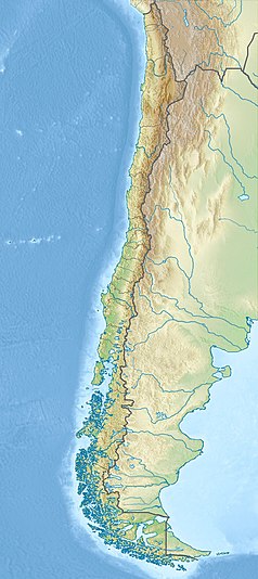
Monte Darwin
 | |
| Państwo | |
|---|---|
| Położenie | Magallanes, Ziemia Ognista, Antarktyka Chilijska, Timaukel↗, Cabo de Hornos↗ |
| Pasmo | |
| Wysokość | 2488 m n.p.m. |
| Pierwsze wejście | 1961 |
Monte Darwin – najwyższy szczyt Ziemi Ognistej. Na wspinaczkę najlepiej wybrać grudzień, styczeń, luty lub marzec. Pierwszego wejścia w 1961 r. dokonali Eric Shipton, E. Garcia, F. Vivanco i C. Marangunic.
Nazwę nadał górze kapitan statku HMS Beagle – Robert FitzRoy, by uczcić 25 urodziny Darwina dnia 12 lutego 1834 r.
Linki zewnętrzne
- Mount Darwin, a climbers challenge and the highest peak in Tierra del Fuego. victory-cruises.com. [zarchiwizowane z tego adresu (2006-02-18)].
Bibliografia
- Adrian Desmond and James Moore, Darwin (London: Michael Joseph, the Penguin Group, 1991). ISBN 0-7181-3430-3
Media użyte na tej stronie
Łatwo można dodać ramkę naokoło tej grafiki
Black up-pointing triangle ▲, U+25B2 from Unicode-Block Geometric Shapes (25A0–25FF)
Autor: Butterfly voyages, Licencja: CC BY-SA 3.0
Mount Darwin, the highest peak in Tierra del Fuego at 2,488 metres (8,163 ft), forms part of the Cordillera of the Andes, South America, just to the north of the Beagle Channel
Autor:
- Chile_location_map.svg: NordNordWest
- derivative work: Виктор В (talk)
Location map of Chile


