Montfaucon-Montigné
| miejscowość | |||
 Kaplica Notre-Dame-de-Toutes-Grâces de la Tulévrière w Montfaucon-Montigné | |||
| |||
| Państwo | |||
|---|---|---|---|
| Region | |||
| Departament | |||
| Okręg | |||
| Kod INSEE | 49206 | ||
| Powierzchnia | 0,29 km² | ||
| Populacja (2008) • liczba ludności |
| ||
| Kod pocztowy | 49230 | ||
Położenie na mapie Maine i Loary (c) Eric Gaba, Wikimedia Commons user Sting, CC BY-SA 3.0 | |||
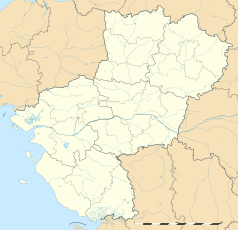
Położenie na mapie Kraju Loary (c) Eric Gaba, Wikimedia Commons user Sting, CC BY-SA 3.0 | |||
| Portal | |||
Montfaucon-Montigné – miejscowość i dawna gmina we Francji, w regionie Kraj Loary, w departamencie Maine i Loara. W 2008 roku populacja ludności wynosiła 1891 mieszkańców[1].
W dniu 15 grudnia 2015 roku z połączenia 10 ówczesnych gmin – Le Longeron, Montfaucon-Montigné, La Renaudière, Roussay, Saint-André-de-la-Marche, Saint-Crespin-sur-Moine, Saint-Germain-sur-Moine, Saint-Macaire-en-Mauges, Tillières oraz Torfou – utworzono nową gminę Sèvremoine. Siedzibą gminy została miejscowość Saint-Macaire-en-Mauges[2].
Przypisy
- ↑ Populations légales 2013. INSEE. [dostęp 2017-01-14]. (fr.).
- ↑ Arrêté du 5 octobre 2015 portant création de la commune nouvelle de Sèvremoine. Legifrance. [dostęp 2017-01-15]. (fr.).
Media użyte na tej stronie
Autor: Superbenjamin, Licencja: CC BY-SA 4.0
Blank administrative map of France for geo-location purpose, with regions and departements distinguished. Approximate scale : 1:3,000,000
(c) Eric Gaba, Wikimedia Commons user Sting, CC BY-SA 3.0
Blank administrative map of the region of Pays de la Loire, France, as in February 2011, for geo-location purpose, with distinct boundaries for regions, departments and arrondissements.
Autor: Chatsam, Licencja: CC BY-SA 3.0
blason de la commune de Montfaucon-Montigné : Écartelé: aux 1er et 4e de sable au faucon d’argent, celui du 1er quartier contourné, aux 2e et 3e de gueules au chêne d’argent
(c) Eric Gaba, Wikimedia Commons user Sting, CC BY-SA 3.0
Blank administrative map of the department of Maine-et-Loire, France, as in January 2018, for geo-location purpose, with distinct boundaries for regions, departments and arrondissements.
Autor: Llann Wé², Licencja: CC BY-SA 3.0
Chapelle Notre-Dame-de-Grâce, la Tulévrière, Fr-49-Montfaucon-Montigné.


