Mouilleron-en-Pareds
| miejscowość | |||
 Kościół w miejscowości Mouilleron-en-Pareds | |||
| |||
| Państwo | |||
|---|---|---|---|
| Region | |||
| Departament | |||
| Okręg | |||
| Kod INSEE | 85154 | ||
| Powierzchnia | 20,07 km² | ||
| Populacja (2013) • liczba ludności |
| ||
| Kod pocztowy | 85390 | ||
Położenie na mapie Wandei (c) Eric Gaba, Wikimedia Commons user Sting, CC BY-SA 3.0 | |||
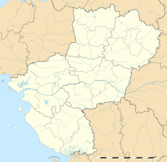
Położenie na mapie Kraju Loary (c) Eric Gaba, Wikimedia Commons user Sting, CC BY-SA 3.0 | |||
| Portal | |||
Mouilleron-en-Pareds – miejscowość i dawna gmina we Francji, w regionie Kraj Loary, w departamencie Wandea. W 2013 roku populacja ludności wynosiła 1444 mieszkańców[1].
W dniu 1 stycznia 2016 roku z połączenia dwóch ówczesnych gmin – Mouilleron-en-Pareds oraz Saint-Germain-l’Aiguiller – utworzono nową gminę Mouilleron-Saint-Germain. Siedzibą gminy została miejscowość Mouilleron-en-Pareds[2].
Przypisy
- ↑ Populations légales 2013. INSEE. [dostęp 2017-01-05]. (fr.).
- ↑ Recueil des Actes Administratif. vendee.gouv.fr. [dostęp 2017-01-05]. (fr.).
Media użyte na tej stronie
Autor: Superbenjamin, Licencja: CC BY-SA 4.0
Blank administrative map of France for geo-location purpose, with regions and departements distinguished. Approximate scale : 1:3,000,000
(c) Eric Gaba, Wikimedia Commons user Sting, CC BY-SA 3.0
Blank administrative map of the region of Pays de la Loire, France, as in February 2011, for geo-location purpose, with distinct boundaries for regions, departments and arrondissements.
Autor: Spouik, Licencja: CC BY-SA 4.0
Église Saint-Hilaire de Mouilleron-en-Pareds
(c) Eric Gaba, Wikimedia Commons user Sting, CC BY-SA 3.0
Blank administrative map of the department of Vendée, France, as in February 2011, for geo-location purpose, with distinct boundaries for regions, departments and arrondissements.


