Moulin de la Galette
| Ten artykuł od 2012-05 wymaga zweryfikowania podanych informacji. |
| ||
 | ||
| Państwo | ||
|---|---|---|
| Region | ||
| Miejscowość | Paryż | |
| Typ budynku | młyn | |
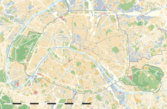
Położenie na mapie Paryża (c) Eric Gaba, Wikimedia Commons user Sting, CC BY-SA 3.0 | ||
Moulin de la Galette jest to wiatrak położony na szczycie dzielnicy Montmartre w Paryżu. Rejon wokół młyna jest popularny wśród paryskich artystów oraz pisarzy. W przeszłości bary oraz kawiarnię wokół Moulin de la Galette były odwiedzane m.in. przez Auguste Renoira, Pablo Picasso, Vincenta van Gogha, Henri de Toulouse-Lautreca oraz Ramona Casasa.
Od 1939 roku młyn posiada status monumentu.
Nad młynem de la Galette powstała restauracja działająca pod nazwą Moulin Radet. Nazwa restauracji wzięła nazwę od nazwiska rodziny która była właścicielem młyna Galette. Wnętrze restauracji jest ozdobione licznymi portretami, głównie autorstwa Renoira.
Media użyte na tej stronie
(c) Eric Gaba, Wikimedia Commons user Sting, CC BY-SA 3.0
Blank land cover map of the city and department of Paris, France, as in January 2012, for geo-location purpose, with distinct boundaries for departments and arrondissements.
Autor: Superbenjamin, Licencja: CC BY-SA 4.0
Blank administrative map of France for geo-location purpose, with regions and departements distinguished. Approximate scale : 1:3,000,000
Autor: Thibault Pelloquin, Licencja: CC BY-SA 3.0
Cette carte représente l'Île de France (en jaune pâle), ses limites départementales et régionales (en traits gris) et ses principaux cours et points d'eau (en bleu). Les départements limitrophes (sont en rose-orange pâle)
Blue Shield - the Distinctive emblem for the Protection of Cultural Property. The distinctive emblem is a protective symbol used during armed conflicts. Its use is restricted under international law.
Autor: Patricia.fidi, Licencja: CC0
Unofficial (de facto) flag of the region Île-de-France in France. It was also the flag of the kingdom of France (s.XIV-XV)


