Mount Adams
 Mount Adams lub Pahto | |
| Państwo | |
|---|---|
| Stan | |
| Położenie | |
| Pasmo | |
| Wysokość | 3744 m n.p.m. |
| Wybitność | 2474 m |
| Pierwsze wejście | 30 lipca 1854 |
Mount Adams – święte miejsce Indian Ameryki Północnej, góra w stanie Waszyngton. Dla Indian z plemienia Yakima ta święta góra to miejsce tradycyjnych pielgrzymek, modlitw, ceremonii, poszukiwania wizji i składania ofiar, wykorzystywane od czasów przed europejską kolonizacją Ameryki Północnej do dziś. Nazywali ją góra Pahto (lub Paddo albo Klickitat). Przejęta przez rząd federalny na przełomie XIX w. i XX w., i włączona do obszaru chronionego Gifford Piechot National Forest. Po wielu latach protestów i apeli zwrócone Indianom Yakima w maju 1972 roku, jako drugi (po Blue Lake w stanie Nowy Meksyk) obszar świętych ziem Indian zwrócony w USA w naturze grupie tubylczych Amerykanów.
Linki zewnętrzne
Media użyte na tej stronie
Autor: Uwe Dedering, Licencja: CC BY-SA 3.0
Relief location map of the USA (without Hawaii and Alaska).
EquiDistantConicProjection : Central parallel :
* N: 37.0° N
Central meridian :
* E: 96.0° W
Standard parallels:
* 1: 32.0° N
* 2: 42.0° N
Made with Natural Earth. Free vector and raster map data @ naturalearthdata.com.
Formulas for x and y:
x = 50.0 + 124.03149777329222 * ((1.9694462586094064-({{{2}}}* pi / 180))
      * sin(0.6010514667026994 * ({{{3}}} + 96) * pi / 180))
y = 50.0 + 1.6155950752393982 * 124.03149777329222 * 0.02613325650382181
      - 1.6155950752393982  * 124.03149777329222 *
     (1.3236744353715044  - (1.9694462586094064-({{{2}}}* pi / 180))
      * cos(0.6010514667026994 * ({{{3}}} + 96) * pi / 180))
The flag of Navassa Island is simply the United States flag. It does not have a "local" flag or "unofficial" flag; it is an uninhabited island. The version with a profile view was based on Flags of the World and as a fictional design has no status warranting a place on any Wiki. It was made up by a random person with no connection to the island, it has never flown on the island, and it has never received any sort of recognition or validation by any authority. The person quoted on that page has no authority to bestow a flag, "unofficial" or otherwise, on the island.
Black up-pointing triangle ▲, U+25B2 from Unicode-Block Geometric Shapes (25A0–25FF)
USGS/Cascades Volcano Observatory photo of Mount Adams
Autor: Carport, Licencja: CC BY-SA 3.0
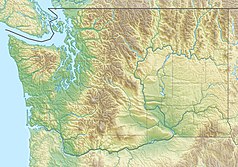
Physical location map of Washington, USA


