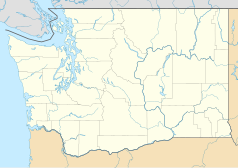
Mount Baker (Góry Kaskadowe)
 Mount Baker i Boulder widok od południowego wschodu | |
| Państwo | |
|---|---|
| Stan | |
| Położenie | |
| Pasmo | |
| Wysokość | 3286 m n.p.m. |
| Pierwsze wejście | 1868 Edmund T. Coleman |

Mount Baker – szczyt w paśmie Gór Kaskadowych na północno-zachodnim w Stanach Zjednoczonych w stanie Waszyngton. Jest to drugi pod względem aktywności wulkan w tym paśmie po Mount St. Helens. Nazwa pochodzi od nazwiska Josepha Bakera - trzeciego oficera w ekspedycji kapitana Vancouvera. George Vancouver badając pacyficzne wybrzeża Ameryki Północnej 30 kwietnia 1791 roku odkrył szczyt dla Europejczyków[1].
Przypisy
- ↑ Cascade Range Volcanoes Volcano Names (ang.). U.S. Department of the Interior U.S. Geological Survey. [dostęp 2014-01-09].
Linki zewnętrzne
Media użyte na tej stronie
Autor: Alexrk2, Licencja: CC BY 3.0
Ta mapa została stworzona za pomocą GeoTools.
Autor: Uwe Dedering, Licencja: CC BY-SA 3.0
Relief location map of the USA (without Hawaii and Alaska).
EquiDistantConicProjection : Central parallel :
* N: 37.0° N
Central meridian :
* E: 96.0° W
Standard parallels:
* 1: 32.0° N
* 2: 42.0° N
Made with Natural Earth. Free vector and raster map data @ naturalearthdata.com.
Formulas for x and y:
x = 50.0 + 124.03149777329222 * ((1.9694462586094064-({{{2}}}* pi / 180))
      * sin(0.6010514667026994 * ({{{3}}} + 96) * pi / 180))
y = 50.0 + 1.6155950752393982 * 124.03149777329222 * 0.02613325650382181
      - 1.6155950752393982  * 124.03149777329222 *
     (1.3236744353715044  - (1.9694462586094064-({{{2}}}* pi / 180))
      * cos(0.6010514667026994 * ({{{3}}} + 96) * pi / 180))
The flag of Navassa Island is simply the United States flag. It does not have a "local" flag or "unofficial" flag; it is an uninhabited island. The version with a profile view was based on Flags of the World and as a fictional design has no status warranting a place on any Wiki. It was made up by a random person with no connection to the island, it has never flown on the island, and it has never received any sort of recognition or validation by any authority. The person quoted on that page has no authority to bestow a flag, "unofficial" or otherwise, on the island.
Black up-pointing triangle ▲, U+25B2 from Unicode-Block Geometric Shapes (25A0–25FF)
Autor: Walter Siegmund, Licencja: CC BY 2.5
The Boulder Glacier with the Sherman (left) and Grant (right) Peaks of Mount Baker behind. Old lateral moraines are visible in the right foreground.
Autor: Alexrk2, Licencja: CC BY 3.0
Ta mapa została stworzona za pomocą GeoTools.
(c) Hike395 z angielskiej Wikipedii, CC BY 3.0
Mount Baker, Washington, United States.
Autor: Walter Siegmund (talk), Licencja: CC BY 2.5
Mount Baker; Grant Peak (10,781 feet, 3286 meters, left center with cloud); Colfax Peak (9440 ft, 2877 m, right center); Lincoln Peak (9080 ft, 2768 m, right)


