Mount Deception
 | |
| Państwo | |
|---|---|
| Stan | |
| Położenie | |
| Pasmo | |
| Wysokość | 2375[1] m n.p.m. |
| Wybitność | 1252 m |
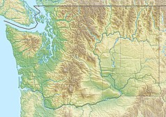
Mount Deception – szczyt w USA, w stanie Waszyngton (Hrabstwo Jefferson), położony 70 km na zachód od Seattle. Jest to drugi pod względem wysokości szczyt gór Olympic Mountains[2]. Szczyt leży na terenie Parku Narodowego Olympic[3].
Szczyt w porównaniu do Mount Olympus ma niewielką liczbę lodowców i jest znacznie skąpiej pokryty śniegiem, gdyż znajduje się w cieniu opadowym łańcucha Bailey, przez co opady są dużo mniejsze niż na znajdującym się bliżej Pacyfiku Mount Olympus. Na szczyt nie prowadzi regularna trasa turystyczna, ale są poprowadzone ścieżki wspinaczkowe[1][4]. Trasa w jedną stronę wynosi około 16 km i trzeba pokonać przewyższenie ponad 1100 m[4].
Przypisy
- ↑ a b Mount Deception. SummitPost.org. [dostęp 2016-03-03]. (ang.).
- ↑ Olympic Mountains. Peakbagger.org. [dostęp 2016-03-03]. (ang.).
- ↑ Olympic National Park, Washington. National Park Service. [dostęp 2016-03-03]. (ang.).
- ↑ a b Mount Olympus, Washington. Peakbagger.org. [dostęp 2016-03-03]. (ang.).
Media użyte na tej stronie
The flag of Navassa Island is simply the United States flag. It does not have a "local" flag or "unofficial" flag; it is an uninhabited island. The version with a profile view was based on Flags of the World and as a fictional design has no status warranting a place on any Wiki. It was made up by a random person with no connection to the island, it has never flown on the island, and it has never received any sort of recognition or validation by any authority. The person quoted on that page has no authority to bestow a flag, "unofficial" or otherwise, on the island.
Black up-pointing triangle ▲, U+25B2 from Unicode-Block Geometric Shapes (25A0–25FF)
Autor: Ron Clausen, Licencja: CC BY-SA 4.0
Mount Deception from Deception Creek. Olympic Mountains
Autor: Carport, Licencja: CC BY-SA 3.0
Physical location map of Washington, USA
Autor: Uwe Dedering, Licencja: CC BY-SA 3.0
Relief location map of the USA (without Hawaii and Alaska).
EquiDistantConicProjection : Central parallel :
* N: 37.0° N
Central meridian :
* E: 96.0° W
Standard parallels:
* 1: 32.0° N
* 2: 42.0° N
Made with Natural Earth. Free vector and raster map data @ naturalearthdata.com.
Formulas for x and y:
x = 50.0 + 124.03149777329222 * ((1.9694462586094064-({{{2}}}* pi / 180))
      * sin(0.6010514667026994 * ({{{3}}} + 96) * pi / 180))
y = 50.0 + 1.6155950752393982 * 124.03149777329222 * 0.02613325650382181
      - 1.6155950752393982  * 124.03149777329222 *
     (1.3236744353715044  - (1.9694462586094064-({{{2}}}* pi / 180))
      * cos(0.6010514667026994 * ({{{3}}} + 96) * pi / 180))


