Mount Mansfield
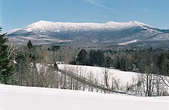
 Widok na Mount Mansfield od strony zachodniej | |
| Państwo | |
|---|---|
| Stan | |
| Położenie | hrabstwa Lamoille i Chittenden |
| Pasmo | |
| Wysokość | 1339 m n.p.m. |
Mount Mansfield – góra w Stanach Zjednoczonych, w paśmie Gór Zielonych (część Appalachów), najwyższe wzniesienie w stanie Vermont (1339 m n.p.m.)[1]. Leży na granicy hrabstw Lamoille i Chittenden, na terenie lasu stanowego Mount Mansfield, około 30 km na wschód od miasta Burlington i jeziora Champlain[2].
Góra ma kilka wierzchołków ułożonych południkowo. Widziane od wschodu układają się one na kształt przypominający nieco profil twarzy człowieka. Ich nazwy pochodzą od poszczególnych jej części, m.in. Forehead (czoło), Nose (nos), Chin (broda, najwyższy szczyt) i Adam′s Apple (jabłko Adama). Na wschodnim stoku funkcjonuje ośrodek narciarski[2].
Przypisy
- ↑ Mount Mansfield, Geographic Names Information System (GNIS) [dostęp 2019-11-17] (ang.).
- ↑ a b Mount Mansfield, [w:] Encyclopædia Britannica [online] [dostęp 2019-11-17] (ang.).
Media użyte na tej stronie
Autor: Uwe Dedering, Licencja: CC BY-SA 3.0
Relief location map of the USA (without Hawaii and Alaska).
EquiDistantConicProjection : Central parallel :
* N: 37.0° N
Central meridian :
* E: 96.0° W
Standard parallels:
* 1: 32.0° N
* 2: 42.0° N
Made with Natural Earth. Free vector and raster map data @ naturalearthdata.com.
Formulas for x and y:
x = 50.0 + 124.03149777329222 * ((1.9694462586094064-({{{2}}}* pi / 180))
      * sin(0.6010514667026994 * ({{{3}}} + 96) * pi / 180))
y = 50.0 + 1.6155950752393982 * 124.03149777329222 * 0.02613325650382181
      - 1.6155950752393982  * 124.03149777329222 *
     (1.3236744353715044  - (1.9694462586094064-({{{2}}}* pi / 180))
      * cos(0.6010514667026994 * ({{{3}}} + 96) * pi / 180))
The flag of Navassa Island is simply the United States flag. It does not have a "local" flag or "unofficial" flag; it is an uninhabited island. The version with a profile view was based on Flags of the World and as a fictional design has no status warranting a place on any Wiki. It was made up by a random person with no connection to the island, it has never flown on the island, and it has never received any sort of recognition or validation by any authority. The person quoted on that page has no authority to bestow a flag, "unofficial" or otherwise, on the island.
Black up-pointing triangle ▲, U+25B2 from Unicode-Block Geometric Shapes (25A0–25FF)
Photo of the Western slope of Mt. Mansfield from the front of my house in Underhill - K. Kemerait
Autor: SANtosito, Licencja: CC BY-SA 4.0
Relief location map of Vermont, USA
Geographic limits of the map:
- N: 45.2° N
- S: 42.5° N
- W: 73.6° W
- E: 71.3° W


