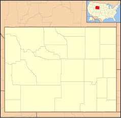
Mount Moran (Wyoming)
| ||
 | ||
| Państwo | ||
|---|---|---|
| Stan | ||
| Położenie | Park Narodowy Grand Teton | |
| Pasmo | Teton Range | |
| Wysokość | 3842 m n.p.m. | |
| Wybitność | 832 m | |
| Pierwsze wejście | 27 lipca 1922 Hardy Rich, Ben c. Rich, Bennet McNulty | |
Mount Moran – góra o wysokości 3843 m n.p.m. na terenie Wyoming w Stanach Zjednoczonych[1][2].
Położenie i okolica
Szczyt znajduje się nad jeziorem Jackson Lake w paśmie górskim Teton Range w Górach Skalistych[3][4]. Jest także najwyższym szczytem w Moran Group[5]. Od wschodu znajdują się szczyty West Horn oraz East Horn, od północy szczyty Traverse Peak i Bivouac Peak, a od południowego zachodu szczyt Thor Peak[6]. Na zboczach góry znajdują się lodowce m.in. Skillet Glacier, Falling Ice Glacier, czy Triple Glaciers. U podnóża góry płynie strumień Moran Creek, znajduje się tam także zatoka Moran Bay oraz wąwóz Moran Canyon. Nazwy tych obiektów pochodzą od szczytu. Pojawiają się tam także liczne jeziorka i potoki m.in. Leigh Lake oraz Leigh Creek[7].
Przypisy
- ↑ Mount Moran, PeakVisor [dostęp 2019-12-30] (ang.).
- ↑ Climbing Mount Moran – CMC Route, Grand Teton National Park, www.timberlinetrails.com [dostęp 2019-12-30].
- ↑ Mount Moran : Climbing, Hiking & Mountaineering : SummitPost, www.summitpost.org [dostęp 2019-12-30].
- ↑ Rock Climbing in Mount Moran, Grand Teton National Park, Mountain Project [dostęp 2019-12-30].
- ↑ Moran Group – Peakbagger.com, www.peakbagger.com [dostęp 2019-12-30].
- ↑ Mount Moran, Mapcarta [dostęp 2019-12-30] (ang.).
- ↑ Mount Moran – Peakbagger.com, www.peakbagger.com [dostęp 2019-12-30].
Media użyte na tej stronie
Autor: Uwe Dedering, Licencja: CC BY-SA 3.0
Relief location map of the USA (without Hawaii and Alaska).
EquiDistantConicProjection : Central parallel :
* N: 37.0° N
Central meridian :
* E: 96.0° W
Standard parallels:
* 1: 32.0° N
* 2: 42.0° N
Made with Natural Earth. Free vector and raster map data @ naturalearthdata.com.
Formulas for x and y:
x = 50.0 + 124.03149777329222 * ((1.9694462586094064-({{{2}}}* pi / 180))
      * sin(0.6010514667026994 * ({{{3}}} + 96) * pi / 180))
y = 50.0 + 1.6155950752393982 * 124.03149777329222 * 0.02613325650382181
      - 1.6155950752393982  * 124.03149777329222 *
     (1.3236744353715044  - (1.9694462586094064-({{{2}}}* pi / 180))
      * cos(0.6010514667026994 * ({{{3}}} + 96) * pi / 180))
The flag of Navassa Island is simply the United States flag. It does not have a "local" flag or "unofficial" flag; it is an uninhabited island. The version with a profile view was based on Flags of the World and as a fictional design has no status warranting a place on any Wiki. It was made up by a random person with no connection to the island, it has never flown on the island, and it has never received any sort of recognition or validation by any authority. The person quoted on that page has no authority to bestow a flag, "unofficial" or otherwise, on the island.
Black up-pointing triangle ▲, U+25B2 from Unicode-Block Geometric Shapes (25A0–25FF)
Ta ^specifik^ z W3C grafika wektorowa została stworzona za pomocą Inkscape.


