Mount Mystery
 | |
| Państwo | |
|---|---|
| Stan | |
| Położenie | |
| Pasmo | |
| Wysokość | 2245[1] m n.p.m. |
| Wybitność | 341 m |
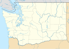
Mount Mystery – masywny, skalisty szczyt w USA, w stanie Waszyngton (Hrabstwo Jefferson), położony 75 km na zachód od Seattle. Jest to jeden z wyższych szczytów gór Olympic Mountains[2][1]. Szczyt leży w centrum Parku Narodowego Olympic[3][1], 35 km na wschód od Mount Olympus.
Ze wierzchołka w kierunku północno-wschodnim spływa duży lodowiec. Najbliższym wyższym szczytem jest odległy o 2,1 km Mount Deception[2]. Szczyt jest dobrze widoczny z wielu miejsc zatoki Puget Sound. Na wierzchołek prowadzi szlak pieszy wiodący z parkingu nad rzeką Dosewallips. Wejście na szlak wymaga uiszczenia opłat za wstęp i obozowanie[1]
Przypisy
- ↑ a b c d Mount Mystery (ang.). SummitPost.org. [dostęp 2016-03-03].
- ↑ a b Mount Mystery, Washington (ang.). Peakbagger.org. [dostęp 2016-03-03].
- ↑ Olympic National Park, Washington (ang.). National Park Service. [dostęp 2016-03-03].
Media użyte na tej stronie
The flag of Navassa Island is simply the United States flag. It does not have a "local" flag or "unofficial" flag; it is an uninhabited island. The version with a profile view was based on Flags of the World and as a fictional design has no status warranting a place on any Wiki. It was made up by a random person with no connection to the island, it has never flown on the island, and it has never received any sort of recognition or validation by any authority. The person quoted on that page has no authority to bestow a flag, "unofficial" or otherwise, on the island.
Black up-pointing triangle ▲, U+25B2 from Unicode-Block Geometric Shapes (25A0–25FF)
Autor: Alexrk2, Licencja: CC BY 3.0
Ta mapa została stworzona za pomocą GeoTools.
Autor: Uwe Dedering, Licencja: CC BY-SA 3.0
Relief location map of the USA (without Hawaii and Alaska).
EquiDistantConicProjection : Central parallel :
* N: 37.0° N
Central meridian :
* E: 96.0° W
Standard parallels:
* 1: 32.0° N
* 2: 42.0° N
Made with Natural Earth. Free vector and raster map data @ naturalearthdata.com.
Formulas for x and y:
x = 50.0 + 124.03149777329222 * ((1.9694462586094064-({{{2}}}* pi / 180))
      * sin(0.6010514667026994 * ({{{3}}} + 96) * pi / 180))
y = 50.0 + 1.6155950752393982 * 124.03149777329222 * 0.02613325650382181
      - 1.6155950752393982  * 124.03149777329222 *
     (1.3236744353715044  - (1.9694462586094064-({{{2}}}* pi / 180))
      * cos(0.6010514667026994 * ({{{3}}} + 96) * pi / 180))


