Mount Scenery
 Zdjęcie satelitarne Saby, Mount Scenery w centrum | |
| Państwo | |
|---|---|
| Gmina specjalna | |
| Położenie | |
| Wysokość | 887 m n.p.m. |
| Wybitność | 887 m |
Mount Scenery – wulkan na wyspie Saba (gmina zamorska Holandii), klasyfikowany jako stratowulkan. Ostatnia erupcja miała miejsce w roku 1640[1]. Mount Scenery jest najwyższym wzniesieniem Królestwa Niderlandów[2].
Szczyt widziany z Windwardside.
Przypisy
- ↑ Saba, volcano.si.edu Smithsonian Institution [dostęp 2019-04-05] (ang.).
- ↑ Highest Points In The Netherlands By Elevation, worldatlas.com [dostęp 2019-04-05] (ang.).
Media użyte na tej stronie
Black up-pointing triangle ▲, U+25B2 from Unicode-Block Geometric Shapes (25A0–25FF)
Autor: Autor nie został podany w rozpoznawalny automatycznie sposób. Założono, że to Lagopus~commonswiki (w oparciu o szablon praw autorskich)., Licencja: CC-BY-SA-3.0
Picture of the trail to the top of the Mount Scenery of the island Saba. Taken by me in 2001 during holidays.
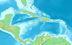
Map of the Caribbean and Central America.
Bounding box West -93°, South 7°, East -58°, North 28°.
Center at 17°30′00″N 75°30′00″W / 17.50000°N 75.50000°W.Autor: Richie Diesterheft, Licencja: CC BY-SA 2.0
Saba island viewed from the north
Autor: Richie Diesterheft, Licencja: CC BY-SA 2.0
Narrow streets of Windwardside with Mount Scenery.


