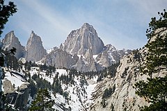
Mount Whitney
 Wschodnie zbocze Mount Whitney | |
| Państwo | |
|---|---|
| Stan | |
| Położenie | |
| Pasmo | |
| Wysokość | 4421 m n.p.m. |
| Pierwsze wejście | 1873 |
Mount Whitney – szczyt w Sierra Nevada w Kalifornii (USA). Wysokość góry wynosi 4421 m (14 505 stóp) n.p.m., dzięki czemu jest to najwyższy szczyt w całej Kalifornii i najwyższy szczyt kontynentalnych Stanów Zjednoczonych. Góra jest zbudowana z granitu.
Nazwa Mount Whitney pochodzi od nazwiska kalifornijskiego geologa - Josiaha Whitneya. Po raz pierwszy została zdobyta w 1873 przez trzyosobową wyprawę, w której skład wchodzili: Charles Begole, A. H. Johnson oraz John Lucas.
Linki zewnętrzne
- Informacje o górze (ang.)
- Mapa góry i okolic na Google Maps (ang.)
Media użyte na tej stronie
Autor: Uwe Dedering, Licencja: CC BY-SA 3.0
Relief location map of the USA (without Hawaii and Alaska).
EquiDistantConicProjection : Central parallel :
* N: 37.0° N
Central meridian :
* E: 96.0° W
Standard parallels:
* 1: 32.0° N
* 2: 42.0° N
Made with Natural Earth. Free vector and raster map data @ naturalearthdata.com.
Formulas for x and y:
x = 50.0 + 124.03149777329222 * ((1.9694462586094064-({{{2}}}* pi / 180))
      * sin(0.6010514667026994 * ({{{3}}} + 96) * pi / 180))
y = 50.0 + 1.6155950752393982 * 124.03149777329222 * 0.02613325650382181
      - 1.6155950752393982  * 124.03149777329222 *
     (1.3236744353715044  - (1.9694462586094064-({{{2}}}* pi / 180))
      * cos(0.6010514667026994 * ({{{3}}} + 96) * pi / 180))
The flag of Navassa Island is simply the United States flag. It does not have a "local" flag or "unofficial" flag; it is an uninhabited island. The version with a profile view was based on Flags of the World and as a fictional design has no status warranting a place on any Wiki. It was made up by a random person with no connection to the island, it has never flown on the island, and it has never received any sort of recognition or validation by any authority. The person quoted on that page has no authority to bestow a flag, "unofficial" or otherwise, on the island.
Flag of California. This version is designed to accurately depict the standard print of the bear as well as adhere to the official flag code regarding the size, position and proportion of the bear, the colors of the flag, and the position and size of the star.
Black up-pointing triangle ▲, U+25B2 from Unicode-Block Geometric Shapes (25A0–25FF)
Autor: Geographer (dyskusja · edycje), Licencja: CC BY 1.0
Mount Whitney
Autor: Jeffrey Pang from Berkeley, CA, USA, Licencja: CC BY 2.0
Mount Whitney at sunrise from Lone Pine, CA. August 2011.


