Moyale
 | |
| Państwo | |
|---|---|
| Hrabstwo | |
| Wysokość | 1100 m n.p.m. |
| Populacja (2019) • liczba ludności |
|
Położenie na mapie Kenii | |
Moyale (poprawnie: Mojalie, fr. Moyalē) – targowe miasto na granicy Kenii z Etiopią. Wg kenijskiego spisu z 2019 liczy 47,8 tys. mieszkańców.
Zobacz też
Media użyte na tej stronie
Autor: Fiver Löcker, Licencja: CC BY-SA 2.0
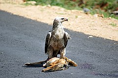
Tawny Eagle with a Black-backed Jackal road traffic victim on the road between Moyale to Awassa in Ethiopia.
(c) Uwe Dedering z niemieckiej Wikipedii, CC BY-SA 3.0
Location map of Kenya
Equirectangular projection. Strechted by 100.0%. Geographic limits of the map:
- N: 6.0° N
- S: -5.0° N
- W: 33.0° E
- E: 43.0° E


