Mutley
| ||
(c) Tony Atkin, CC BY-SA 2.0 | ||
| Państwo | ||
| Kraj | ||
| Region | South West England | |
| Hrabstwo ceremonialne | Devon | |
| Unitary authority | Plymouth | |
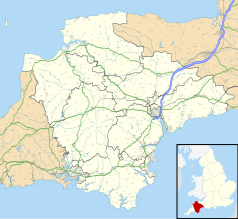
Położenie na mapie Devonu Contains Ordnance Survey data © Crown copyright and database right, CC BY-SA 3.0 | ||
| 50°22′55,9″N 4°08′03,1″W/50,382194 -4,134194 | ||
| Portal | ||
Mutley – dzielnica miasta Plymouth, w Anglii, w Devon, w dystrykcie (unitary authority) Plymouth[1]. Mutley jest wspomniana w Domesday Book (1086) jako Modlei/Modleia[2].
Przypisy
|
Media użyte na tej stronie
Flag of England. Saint George's cross (a red cross on a white background), used as the Flag of England, the Italian city of Genoa and various other places.
Contains Ordnance Survey data © Crown copyright and database right, CC BY-SA 3.0
Map of Devon, UK with the following information shown:
- Administrative borders
- Coastline, lakes and rivers
- Motorways and primary routes
- Urban areas
Equirectangular map projection on WGS 84 datum, with N/S stretched 150%
Geographic limits:
- West: 4.72W
- East: 2.86W
- North: 51.3N
- South: 50.16N
(c) Tony Atkin, CC BY-SA 2.0
Mutley Plain, Plymouth. Traffic, bars and fast food takeaways, Mutley Plain is regarded as being the heart of Plymouth's "student" district.
Autor: NordNordWest, Licencja: CC BY-SA 3.0
Location map of the United Kingdom


