Muzeum Indyjskie w Kolkacie
© Vyacheslav Argenberg / http://www.vascoplanet.com/, CC BY 4.0 Wirydarz Muzeum Indyjskiego w Kolkacie | |
| Państwo | |
|---|---|
| Miejscowość | |
| Adres | 27 Jawaharlal Nehru Road, Kolkata 700016 |
| Data założenia | 1814 |
| Dyrektor | Shri Arijit Dutta Choudhury |
Położenie na mapie Indii | |
Położenie na mapie Bengalu Zachodniego (c) Karte: NordNordWest, Lizenz: Creative Commons by-sa-3.0 de | |
| Strona internetowa | |
Muzeum Indyjskie w Kolkacie – muzeum założone w 1814 przez duńskiego botanika dra Nathaniela Wallicha w Serampore (nazywanego pierwotnie Frederischnagore) koło Kolkaty w Indiach. Jest jednym z najstarszych muzeów na świecie, gromadzącym obiekty z różnych dziedzin.
Muzeum Indyjskie było pierwszą tego typu placówką w Azji. W latach 1814–1878 mieściło się w siedzibie The Royal Asiatic Society of Bengal w Kolkacie. Następnie wybudowano okazałą siedzibę, dla lepszej prezentacji zbiorów (Maidan of Calcutta, J.L. Nehru Road, Kolkata-72).
W salach muzealnych prezentowane są: szkielety dinozaurów, meteoryty, egiskie mumie, stupy z Barhut, prochy Byddy, kolumny Asioki (kamienne lwy z głowicy stały się godłem Indii), jak również pokaźne kolekcje rzadkich antyków i sztuki indyjskiej.
Media użyte na tej stronie
(c) Uwe Dedering z niemieckiej Wikipedii, CC BY-SA 3.0
Location map of India.
Equirectangular projection. Strechted by 106.0%. Geographic limits of the map:
- N: 37.5° N
- S: 5.0° N
- W: 67.0° E
- E: 99.0° E
The Flag of India. The colours are saffron, white and green. The navy blue wheel in the center of the flag has a diameter approximately the width of the white band and is called Ashoka's Dharma Chakra, with 24 spokes (after Ashoka, the Great). Each spoke depicts one hour of the day, portraying the prevalence of righteousness all 24 hours of it.
Autor: Philg88; Attribution: Wikimedia Foundation (www.wikimedia.org), Licencja: CC BY 4.0
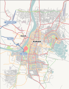
Kolkata, India. Location map
(c) Karte: NordNordWest, Lizenz: Creative Commons by-sa-3.0 de
Location map of West Bengal, India
© Vyacheslav Argenberg / http://www.vascoplanet.com/, CC BY 4.0
Indian Museum, also the Imperial Museum at Calcutta, the oldest and one of the largest museums in India. Kolkata, Calcutta, West Bengal, India.


