Myrnohrad
| |||||
(c) Photo: Kharkivian (Serhii Petrov). From Wikimedia Commons. License CC BY-SA 4.0. Фото: Kharkivian (Сергій Петров). З Wikimedia Commons. Ліцензія CC BY-SA 4.0 | |||||
| |||||
| Państwo | |||||
| Obwód | |||||
| Populacja (2021) • liczba ludności | 46 904[1] | ||||
| Kod pocztowy | 85320–85329 | ||||
Położenie na mapie Ukrainy (c) Karte: NordNordWest, Lizenz: Creative Commons by-sa-3.0 de | |||||
| Strona internetowa | |||||
| Portal | |||||
Myrnohrad (ukr. Мирноград) – miasto na Ukrainie, w obwodzie donieckim. Do 2016 roku nosiło nazwę Dymytrow (ukr. Димитров)[2].
Demografia
Przypisy
- ↑ a b Чисельність наявного населення України на 1 січня 2021 року, ukrcensus.gov.ua [dostęp 2021-08-18] (ukr.).
- ↑ Дніпропетровськ перейменували на Дніпро [dostęp 2021-08-19] (ukr.).
- ↑ ЧИСЕЛЬНІСТЬ НАЯВНОГО НАСЕЛЕННЯ УКРАЇНИ на 1 січня 2014 року [dostęp 2021-08-19] (ukr.).
Media użyte na tej stronie
Ukraine adm location map.svg
(c) Karte: NordNordWest, Lizenz: Creative Commons by-sa-3.0 de
Location map of Ukraine
(c) Karte: NordNordWest, Lizenz: Creative Commons by-sa-3.0 de
Location map of Ukraine
Stakhanov Coal Mine. Administrative Building.JPG
(c) Photo: Kharkivian (Serhii Petrov). From Wikimedia Commons. License CC BY-SA 4.0.
Фото: Kharkivian (Сергій Петров). З Wikimedia Commons. Ліцензія CC BY-SA 4.0
Шахта імені О.Г. Стаханова у м. Мирноград. Головна адміністративна будівля.
(c) Photo: Kharkivian (Serhii Petrov). From Wikimedia Commons. License CC BY-SA 4.0.
Фото: Kharkivian (Сергій Петров). З Wikimedia Commons. Ліцензія CC BY-SA 4.0
Шахта імені О.Г. Стаханова у м. Мирноград. Головна адміністративна будівля.
Coat of Arms of Donetsk Oblast 1999.svg
Герб Донецької области (Україна)
Герб Донецької области (Україна)
Myrnohrad gerb big.png
Герб Мирнограда
Герб Мирнограда
Donetsk Oblast location map.svg
Autor: RosssW, Licencja: CC BY-SA 4.0
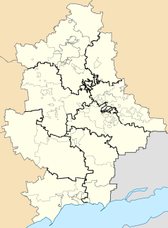
Districts of the Donetsk region of Ukraine according to the Decree of the Verkhovna Rada of July 17, 2020 against the background of the old administrative boundaries of districts and cities of regional significance (city councils) and displaying the territories of the unrecognized DPR that are not controlled by the Ukrainian authorities.


