Nelson Mandela Park
 Nelson Mandela Park | |
| Państwo | |
|---|---|
| Miejscowość | |
| Dzielnica | Centrum miasta |
| Powierzchnia | 3,4 ha |
| Data założenia | 6 sierpnia 1986 |
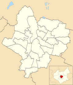
Położenie na mapie Leicesteru Contains Ordnance Survey data © Crown copyright and database right, CC BY-SA 3.0 | |
Położenie na mapie Wielkiej Brytanii (c) Karte: NordNordWest, Lizenz: Creative Commons by-sa-3.0 de | |
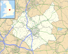
Położenie na mapie Leicestershire Contains Ordnance Survey data © Crown copyright and database right, CC BY-SA 3.0 | |
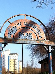
Nelson Mandela Park – park położony w środkowej części miasta Leicester o powierzchni 3,4 ha. otwarty 6 sierpnia 1986 r. Park otoczony jest ulicami Welford Road, Lancaster Road oraz Tigers Way. Obok parku znajduje się więzienie, Stadion Leicester Tigers, HMP (firma transportu publicznego). W parku znajduje się kamień z tablicą upamiętniającą Nelsona Mandelę[1].
Zobacz też
- Abbey Park
- Victoria Park
Przypisy
- ↑ Memorial at Nelson Mandela Park in Leicester | Central - ITV News, www.itv.com [dostęp 2017-11-19] (ang.).
Media użyte na tej stronie
(c) Karte: NordNordWest, Lizenz: Creative Commons by-sa-3.0 de
Location map of the United Kingdom
Shiny green button/marker widget.
Contains Ordnance Survey data © Crown copyright and database right, CC BY-SA 3.0
Map of Leicester, Leicestershire, UK with electoral wards shown.
Equirectangular map projection on WGS 84 datum, with N/S stretched 160%
Geographic limits:
- West: 1.22W
- East: 1.04W
- North: 52.70N
- South: 52.57N
Contains Ordnance Survey data © Crown copyright and database right, CC BY-SA 3.0
Map of Leicestershire, UK with the following information shown:
- Administrative borders
- Coastline, lakes and rivers
- Roads and railways
- Urban areas
Equirectangular map projection on WGS 84 datum, with N/S stretched 160%
Geographic limits:
- West: 1.80W
- East: 0.50W
- North: 53.00N
- South: 52.36N
Autor: Joshuajohnlee., Licencja: CC BY 3.0
The sign at one of the entrances to Nelson Mandela Park, Leicester, UK.


