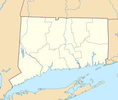
New Haven
 | |
| Przydomek: The Elm City (Miasto wiązów) | |
| Państwo | |
|---|---|
| Stan | |
| Hrabstwo | |
| Data założenia | 1638[1] |
| Prawa miejskie | 1784[1] |
| Kod statystyczny | |
| Burmistrz | Toni Harp |
| Powierzchnia | 52,6 km² |
| Wysokość | 18 m n.p.m. |
| Populacja (2012) • liczba ludności • gęstość |
|
| Nr kierunkowy | 203 |
| Kod pocztowy | 06501-06540 |
| Strefa czasowa | |
| Strona internetowa | |
| Portal | |
New Haven – miasto w północno-wschodniej części Stanów Zjednoczonych, w stanie Connecticut, ośrodek administracyjny hrabstwa New Haven. W 2019 miasto posiadało ponad 130 tys. mieszkańców[2].
Miasto jest częścią nowojorskiego obszaru metropolitalnego, liczącego 21,2 mln mieszkańców (2000).
W mieście rozwinął się przemysł maszynowy, odzieżowy, stoczniowy oraz elektroniczny[1].
Szkoły wyższe
- Uniwersytet Yale’a, jedna z elitarnych uczelni w Stanach Zjednoczonych
- Uniwersytet Stanowy Południowego Connecticut (Southern Connecticut State University)
- Albertus Magnus College
- Gateway Community College
Religia
- parafia św. Stanisława Biskupa i Męczennika
Transport
- stacja kolejowa New Haven Union Station
Miasta partnerskie
 Afula (Izrael)
 Amalfi (Włochy)
 Awinion (Francja)
 Freetown (Sierra Leone)
 Huế (Wietnam)
 León (Nikaragua)
 Taizhong (Republika Chińska)
Linki zewnętrzne
- New Haven w bazie city-data.com (ang.)
Przypisy
- ↑ a b c New Haven, [w:] Encyklopedia PWN [online] [dostęp 2021-07-31].
- ↑ US Census Bureau, Population and Housing Unit Estimates Tables, The United States Census Bureau [dostęp 2020-09-04] (ang.).
Media użyte na tej stronie
Autor: Uwe Dedering, Licencja: CC BY-SA 3.0
Location map of the USA (without Hawaii and Alaska).
EquiDistantConicProjection:
Central parallel:
* N: 37.0° N
Central meridian:
* E: 96.0° W
Standard parallels:
* 1: 32.0° N
* 2: 42.0° N
Made with Natural Earth. Free vector and raster map data @ naturalearthdata.com.
Formulas for x and y:
x = 50.0 + 124.03149777329222 * ((1.9694462586094064-({{{2}}}* pi / 180))
      * sin(0.6010514667026994 * ({{{3}}} + 96) * pi / 180))
y = 50.0 + 1.6155950752393982 * 124.03149777329222 * 0.02613325650382181
      - 1.6155950752393982  * 124.03149777329222 *
     (1.3236744353715044  - (1.9694462586094064-({{{2}}}* pi / 180))
      * cos(0.6010514667026994 * ({{{3}}} + 96) * pi / 180))
The flag of Navassa Island is simply the United States flag. It does not have a "local" flag or "unofficial" flag; it is an uninhabited island. The version with a profile view was based on Flags of the World and as a fictional design has no status warranting a place on any Wiki. It was made up by a random person with no connection to the island, it has never flown on the island, and it has never received any sort of recognition or validation by any authority. The person quoted on that page has no authority to bestow a flag, "unofficial" or otherwise, on the island.
Flag of Israel. Shows a Magen David (“Shield of David”) between two stripes. The Shield of David is a traditional Jewish symbol. The stripes symbolize a Jewish prayer shawl (tallit).
Autor: Alexrk2, Licencja: CC BY 3.0
Ta mapa została stworzona za pomocą GeoTools.
Autor: Several wiki contributors for initial images, myself for their combination, Licencja: GFDL
Montage of New Haven from files scattered around Wikipedia. Clockwise from the top are the city skyline, East Rock Park, summer festivities on the New Haven Green, shops along Upper State Street, Five Mile Point Lighthouse, Harkness Tower, and Connecticut House at Yale.
Individual photos are at:


