Newport (Gwent)
| |||
| Państwo | |||
|---|---|---|---|
| Księstwo | |||
| Hrabstwo | |||
| Populacja (2011) • liczba ludności |
| ||
| Nr kierunkowy | 01633 | ||
| Kod pocztowy | NP1 NP2 NP3 | ||
Położenie na mapie Newport Contains Ordnance Survey data © Crown copyright and database right, CC BY-SA 3.0 | |||
Położenie na mapie Wielkiej Brytanii (c) Karte: NordNordWest, Lizenz: Creative Commons by-sa-3.0 de | |||
| Strona internetowa | |||
| Portal | |||
Newport (wal. Casnewydd) – miasto w Wielkiej Brytanii (Walia) w hrabstwie Newport, od 2002 posiadające status city[1], port przy ujściu rzeki Usk do Kanału Bristolskiego. W 2011 roku miasto liczyło 128 060 mieszkańców[2].
Gospodarka
W mieście rozwinął się przemysł maszynowy, elektrotechnicznej, chemiczny, odzieżowy, papierniczy oraz hutniczy[3].
Sport
Znajduje się tu klub rugby Newport Rugby Club, piłki nożnej – Newport County A.F.C. oraz żużlowy – Newport Wasps, a także stadion Newport Stadium. Jednym z ważniejszych wydarzeń sportowych w mieście jest turniej snookera Welsh Open. W 2010 w okolicy odbył się turniej golfowy Ryder Cup.
Osoby urodzone w Newport
- Desmond Llewelyn – brytyjski (walijski) aktor, występował w roli Q w serii filmów o Jamesie Bondzie
Miasta partnerskie
Przypisy
- ↑ Diamond Jubilee: Bolton and Stockport unsuccessful in city bids. BBC News Manchester, 14 marca 2012. [dostęp 2013-05-10]. (ang.).
- ↑ Newport, [w:] Encyclopædia Britannica [online] [dostęp 2016-10-30] (ang.).
- ↑ Newport, [w:] Encyklopedia PWN [online] [dostęp 2021-08-01].
Media użyte na tej stronie
(c) Karte: NordNordWest, Lizenz: Creative Commons by-sa-3.0 de
Location map of the United Kingdom
The flag of Navassa Island is simply the United States flag. It does not have a "local" flag or "unofficial" flag; it is an uninhabited island. The version with a profile view was based on Flags of the World and as a fictional design has no status warranting a place on any Wiki. It was made up by a random person with no connection to the island, it has never flown on the island, and it has never received any sort of recognition or validation by any authority. The person quoted on that page has no authority to bestow a flag, "unofficial" or otherwise, on the island.
Autor: NordNordWest, Licencja: CC BY-SA 3.0
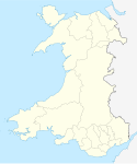
Location map of Wales, United Kingdom
Contains Ordnance Survey data © Crown copyright and database right, CC BY-SA 3.0
Blank map of Newport, UK with the following information shown:
- Administrative borders
- Coastline, lakes and rivers
- Roads and railways
- Urban areas
Equirectangular map projection on WGS 84 datum, with N/S stretched 160%
Geographic limits:
- West: 3.15W
- East: 2.78W
- North: 51.67N
- South: 51.47N
(c) Owain z angielskojęzycznej Wikipedii, CC-BY-SA-3.0
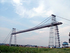
en:Newport Transporter Bridge seen from the east bank, en:17 August en:2002.
Joe D (t) 14:47, 29 August 2006 (UTC):
- Fiddled with levels to correct muddy colours
- Unsharp mask 50% 1px to make the details stand out


