Nhamundá
 | |||||
| Państwo | |||||
|---|---|---|---|---|---|
| Stan | |||||
| Data założenia | 1956 | ||||
| Powierzchnia | 14.105,590[1] km² | ||||
| Wysokość | 50 m n.p.m. | ||||
| Populacja (2010) • liczba ludności • gęstość |
| ||||
| Nr kierunkowy | 92 | ||||
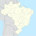
Nhamundá – miasto i gmina w Brazylii, w stanie Amazonas. Znajduje się w mezoregionie Centro Amazonense i mikroregionie Parintins.
Przypisy
- ↑ IBGE | Cidades | Amazonas | Nhamundá | Síntese das Informações, cidades.ibge.gov.br [dostęp 2017-11-15].
- ↑ Censo Populacional 2010
Media użyte na tej stronie
Flag of Amazonas, state of Brazil
Nhamundá...A Terra das Icamiabas!
Bandeira de Nhamundá.
Autor:
- Amazonas_MesoMicroMunicip.svg: Raphael Lorenzeto de Abreu
- derivative work: Milenioscuro (talk)
Location map of Amazonas state. Geographic limits of the map:
- N: 2.6° N
- S: 10.1° S
- W: 74.05° W
- E: 55.9° W
Brasão de Nhamundá.


