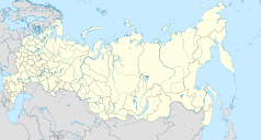
Niżnieangarsk
| ||
| Państwo | ||
|---|---|---|
| Republika | ||
| Data założenia | 1643 | |
| Prawa miejskie | 1938 | |
| Wysokość | 460 m n.p.m. | |
| Populacja (2002) • liczba ludności | 5499 | |
| Nr kierunkowy | (+7) 30130 | |
| Kod pocztowy | 671710 | |
| Tablice rejestracyjne | 03 | |
| Strona internetowa | ||
| Portal | ||
Niżnieangarsk – osiedle typu miejskiego w Rosji, w Buriacji, 450 km na północny wschód od Ułan-Ude. W 2002 liczyło 5499 mieszkańców[1].
Przypisy
- ↑ FSSS. Main, www.gks.ru [dostęp 2017-11-25].
Media użyte na tej stronie
Autor: Uwe Dedering, Licencja: CC BY-SA 3.0
Location map of Russia.
EquiDistantConicProjection : Central parallel :
* N: 54.0° N
Central meridian :
* E: 100.0° E
Standard parallels:
* 1: 49.0° N
* 2: 59.0° N
Made with Natural Earth. Free vector and raster map data @ naturalearthdata.com.
Because the southern Kuril islands are claimed by Russia and Japan, they are shown as disputed. For more information about this see: en:Kuril Islands dispute. These islands are since 1945 under the jurisdiction of the Russian Federation.
Позиционная карта Бурятии
Равноугольная проекция, растяжение — 165%. Координаты краёв:
- север — 57.5° С
- юг — 49.5° С
- восток — 117.0° В
- запад — 98.0° В
Autor: Alexander V. Solomin, Licencja: CC BY-SA 3.0
Theotokos of Vladimir church in Nizhneangarsk, Buryatia, Russia


