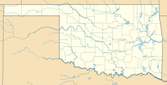
Norman (Oklahoma)
| ||
 | ||
| Państwo | ||
| Stan | ||
| Burmistrz | Cindy Rosenthal | |
| Powierzchnia | 490,6 km² | |
| Wysokość | 357 m n.p.m. | |
| Populacja (2009) • liczba ludności • gęstość | 110 000[1] 224,22 os./km² | |
| Nr kierunkowy | 405 | |
| Kod pocztowy | 73000-73099 | |
| Strona internetowa | ||
| Portal | ||
Norman – miasto w Stanach Zjednoczonych, w stanie Oklahoma, w hrabstwie Cleveland (Cleveland County). Miasto to wchodzi w skład zespołu miejskiego stolicy stanu, Oklahoma City i jest położone około 35 km na południe od niego.
Demografia
Liczba mieszkańców: 111 tys. (2010)
Powierzchnia: 490,6 km²
Według danych z 2017 roku 78,2% mieszkańców Norman stanowiła ludność biała (72,8% nie licząc Latynosów), 7,8% miało rasę mieszaną, 4,8% to Azjaci, 4,5% to Afroamerykanie, 3,5% to rdzenna ludność Ameryki, 0,1% to Hawajczycy i mieszkańcy innych wysp Pacyfiku. Latynosi stanowią 7,5% ludności miasta[2].
Gospodarka
W mieście rozwinął się przemysł elektroniczny, lotniczy oraz spożywczy[1].
Oświata
W mieście Norman znajduje się siedziba stanowej wyższej uczelni - University of Oklahoma.
Sport
W mieście rozgrywane są kobiece turnieje tenisa ziemnego pod nazwą Sooner Open, zaliczane do rangi ITF, z pulą nagród 25 000 $[3].
Miasta partnerskie
 Clermont-Ferrand, Francja
 Colima, Meksyk
 Seika, Japonia
Przypisy
- ↑ a b Norman, [w:] Encyklopedia PWN [online] [dostęp 2021-08-01].
- ↑ U.S. Census Bureau QuickFacts: Norman city, Oklahoma, www.census.gov [dostęp 2019-01-29] (ang.).
- ↑ Women's Tournament Information, www.usta.com [dostęp 2020-07-09] (ang.).
Media użyte na tej stronie
Autor: Uwe Dedering, Licencja: CC BY-SA 3.0
Location map of the USA (without Hawaii and Alaska).
EquiDistantConicProjection:
Central parallel:
* N: 37.0° N
Central meridian:
* E: 96.0° W
Standard parallels:
* 1: 32.0° N
* 2: 42.0° N
Made with Natural Earth. Free vector and raster map data @ naturalearthdata.com.
Formulas for x and y:
x = 50.0 + 124.03149777329222 * ((1.9694462586094064-({{{2}}}* pi / 180))
      * sin(0.6010514667026994 * ({{{3}}} + 96) * pi / 180))
y = 50.0 + 1.6155950752393982 * 124.03149777329222 * 0.02613325650382181
      - 1.6155950752393982  * 124.03149777329222 *
     (1.3236744353715044  - (1.9694462586094064-({{{2}}}* pi / 180))
      * cos(0.6010514667026994 * ({{{3}}} + 96) * pi / 180))
The flag of Navassa Island is simply the United States flag. It does not have a "local" flag or "unofficial" flag; it is an uninhabited island. The version with a profile view was based on Flags of the World and as a fictional design has no status warranting a place on any Wiki. It was made up by a random person with no connection to the island, it has never flown on the island, and it has never received any sort of recognition or validation by any authority. The person quoted on that page has no authority to bestow a flag, "unofficial" or otherwise, on the island.
Autor: Alexrk, Licencja: CC BY 3.0
Ta mapa została stworzona za pomocą GeoTools.
(c) Michael Barera, CC BY-SA 4.0
Bizzell Memorial Library on the campus of the University of Oklahoma in Norman, Oklahoma (United States).
Autor: Okguy, Licencja: CC BY-SA 3.0
OU Campus Corner in Norman, OK. Taken in front of Cafe Plaid.


