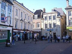
Northampton (borough)
| dystrykt niemetropolitalny | |
(c) Nicholas Mutton, CC BY-SA 2.0 Northampton | |
| Państwo | |
|---|---|
| Kraj | |
| Region | East Midlands |
| Hrabstwo | Northamptonshire |
| Powierzchnia | 80,76 km² |
| Populacja (2011) • liczba ludności | 212 069 |
| • gęstość | 2626 os./km²[1] |
| Położenie na mapie Northamptonshire Contains Ordnance Survey data © Crown copyright and database right, CC BY-SA 3.0 | |
| Strona internetowa | |
| Portal | |
Northampton – dystrykt w hrabstwie Northamptonshire w Anglii. W 2011 roku dystrykt liczył 212 069 mieszkańców[2].
Miasta
Civil parishes
- Billing, Duston, East Hunsbury, Far Cotton and Delapre, Great Houghton, Hardingstone, Hunsbury Meadows, Kingsthorpe, Northampton, Upton, West Hunsbury i Wootton[3].
Przypisy
- ↑ The Guardian
- ↑ Neighbourhood Statistics. [dostęp 2015-10-03]. [zarchiwizowane z tego adresu (2015-10-07)].
- ↑ Ordnance Survey linked data
Media użyte na tej stronie
Flag of England. Saint George's cross (a red cross on a white background), used as the Flag of England, the Italian city of Genoa and various other places.
(c) Nicholas Mutton, CC BY-SA 2.0
Northampton town centre
Contains Ordnance Survey data © Crown copyright and database right, CC BY-SA 3.0
Map of Northamptonshire, UK with Northampton highlighted.
Equirectangular map projection on WGS 84 datum, with N/S stretched 160%


