Oakland
 | |||||
| Przydomek: Oaktown, The O, The Town | |||||
| Państwo | |||||
|---|---|---|---|---|---|
| Stan | |||||
| Hrabstwo | |||||
| Data założenia | 4 maja 1852[1] | ||||
| Kod statystyczny | |||||
| Burmistrz | Elizabeth Beckman Schaaf | ||||
| Powierzchnia | 202,024 km² | ||||
| Wysokość | 13 m n.p.m. | ||||
| Populacja (2020) • liczba ludności |
| ||||
| Nr kierunkowy | 510 | ||||
| Kod pocztowy | 94601, 94602, 94603, 94605, 94606, 94607, 94610, 94611, 94612, 94618, 94619, 94615, 94621 | ||||
| Strefa czasowa | |||||
Położenie na mapie Kalifornii  | |||||
Położenie na mapie Stanów Zjednoczonych  | |||||
| 37°48′N 122°15′W/37,800000 -122,250000 | |||||
| Strona internetowa | |||||
| Portal | |||||

Oakland – miasto w Stanach Zjednoczonych, w środkowo-zachodniej Kalifornii, ośrodek administracyjny hrabstwa Alameda, położone na wschodnim brzegu zatoki San Francisco, naprzeciw miasta San Francisco. W 2020 roku miasto liczyło 440 646 mieszkańców. Główny ośrodek zespołu miejskiego Oakland–Berkeley–Livermore, zamieszkanego przez 2 848 280 osób (2020), wchodzącego w skład większego obszaru metropolitalnego San Francisco Bay Area[2].
Miasto założone zostało w 1852 roku[1]. Oakland jest ośrodkiem transportowym, przemysłowym oraz usługowym. W mieście rozwinął się przemysł środków transportu, spożywczy, metalowy, maszynowy, chemiczny oraz elektrotechniczny[3]. Port w Oakland jest jednym z największych pod względem wielkości przeładunku portów towarowym w Stanach Zjednoczonych (w 2020 roku ósmym co do wielkości w kraju, a trzecim w Kalifornii[a])[4]. Znajduje się tu międzynarodowy port lotniczy.
W Oakland urodził się Robert Flynn z Machine Head; mieszkają tam wokalista i gitarzysta Billie Joe Armstrong i basista Mike Dirnt (obaj z zespołu Green Day). W miejscowości karierę rozpoczęli raperzy G-Eazy, Todd Anthony Shaw (znany jako Too Short) oraz Keak da Sneak, a także MC Hammer.
W Oakland swoją siedzibę miał klub NBA Golden State Warriors.
Miasta partnerskie
 Dalian, Chińska Republika Ludowa
 Fukuoka, Japonia
 Nachodka, Rosja
 Ocho Rios, Jamajka
 Sekondi-Takoradi, Ghana
 Santiago de Cuba, Kuba
 Agadir, Maroko
 Ułan Bator, Mongolia
 Auckland, Nowa Zelandia
 Đà Nẵng, Wietnam
 Funchal, Portugalia
 Bahyr Dar, Etiopia
 Livorno, Włochy
Galeria

Ratusz miasta Oakland i plac centralny (1917)
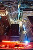
Oakland nocą
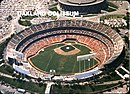
Stadion Oakland Coliseum
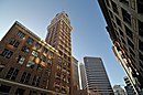
Wieżowiec Tribune Tower widoczny z ulic 13. i Franklin
Widok z budynku Tribune Tower

Jezioro Merritt

Widok na miasto z lotu ptaka
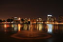
Oakland nocą

Upper Rockridge
Zobacz też
- Temple Sinai
Uwagi
- ↑ Większe są porty w Los Angeles i Long Beach.
Przypisy
- ↑ a b California Cities by Incorporation Date. California Association of Local Agency Formation Commissions. [dostęp 2015-11-16]. (ang.).
- ↑ Oakland, [w:] Encyclopædia Britannica [online] [dostęp 2022-04-15] (ang.).
- ↑ Oakland, [w:] Encyklopedia PWN [online] [dostęp 2021-08-02].
- ↑ Top 10: The busiest container ports in the United States. Container News, 2021-07-18. [dostęp 2022-04-15]. (ang.).
Linki zewnętrzne
Media użyte na tej stronie

The flag of Navassa Island is simply the United States flag. It does not have a "local" flag or "unofficial" flag; it is an uninhabited island. The version with a profile view was based on Flags of the World and as a fictional design has no status warranting a place on any Wiki. It was made up by a random person with no connection to the island, it has never flown on the island, and it has never received any sort of recognition or validation by any authority. The person quoted on that page has no authority to bestow a flag, "unofficial" or otherwise, on the island.

Flag of California. This version is designed to accurately depict the standard print of the bear as well as adhere to the official flag code regarding the size, position and proportion of the bear, the colors of the flag, and the position and size of the star.


Flag of Jamaica. “The sunshine, the land is green, and the people are strong and bold” is the symbolism of the colours of the flag. GOLD represents the natural wealth and beauty of sunlight; GREEN represents hope and agricultural resources; BLACK represents the strength and creativity of the people. The original symbolism, however, was "Hardships there are, but the land is green, and the sun shineth", where BLACK represented the hardships being faced.


Flag of New Zealand. Specification: http://www.mch.govt.nz/nzflag/description.html , quoting New Zealand Gazette, 27 June 1902.


Flag of Portugal, created by Columbano Bordalo Pinheiro (1857-1929), officially adopted by Portuguese government in June 30th 1911 (in use since about November 1910). Color shades matching the RGB values officially reccomended here. (PMS values should be used for direct ink or textile; CMYK for 4-color offset printing on paper; this is an image for screen display, RGB should be used.)

Flag of Ethiopia


Aerial view of city of Oakland, California. Lakeside Park, Lake Merritt in center, Laney College to the right of that, Downtown Oakland right below the lake, Interstate 580 on left, Interstate 980 on bottom, Oakland Inner Harbor Channel and Government Island in upper right.

Autor: rbotman01, Licencja: CC BY-SA 2.0
Upper Rockridge neighborhood — in Oakland, California.
- by rbotman1

Autor: Daniel Ramirez, Licencja: CC BY 2.0
Lake Merritt, by Daniel Ramirez

Autor: Hitchster, Licencja: CC BY 2.0
Tribune Tower, from 13th and Franklin St. in Downtown Oakland, Jan 2009, by Hitchster

Flag of Oakland, California. Image created by uploader based on image found at nava.org.

Autor: This photo (C) Lars Aronsson, Licencja: CC SA 1.0
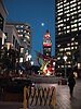
Downtown Oakland City Center, with Tribune Tower and sculpture, at night.
| Pozycja fotografa | | To i inne zdjęcia na: OpenStreetMap |
|---|

Promotional photograph of the new City Hall building in Oakland, California, circa 1917. Built in 1914 at a cost of US$2M, "this unique and beautiful building... symbolizes the aspirations and progress of the City." Photograph commissioned by Oakland Chamber of Commerce, Publicity Bureau. Photographer from Cheney Photo Advertising Co. Original photo part of Oakland Public Library, Oakland History Room. "Public domain. No restrictions on use."

The checklist card of the 1984 Mother's Cookies Oakland Athletics trading cards set. An aerial photograph of the Oakland Coliseum appears on the front of the card and a checklist of all 28 of the trading cards in the set appears on the back.
- The card is numbered #28 in the set.

Autor: Uwe Dedering, Licencja: CC BY-SA 3.0
Relief location map of the USA (without Hawaii and Alaska).
EquiDistantConicProjection : Central parallel :
* N: 37.0° N
Central meridian :
* E: 96.0° W
Standard parallels:
* 1: 32.0° N
* 2: 42.0° N
Made with Natural Earth. Free vector and raster map data @ naturalearthdata.com.
Formulas for x and y:
x = 50.0 + 124.03149777329222 * ((1.9694462586094064-({{{2}}}* pi / 180))
      * sin(0.6010514667026994 * ({{{3}}} + 96) * pi / 180))
y = 50.0 + 1.6155950752393982 * 124.03149777329222 * 0.02613325650382181
      - 1.6155950752393982  * 124.03149777329222 *
     (1.3236744353715044  - (1.9694462586094064-({{{2}}}* pi / 180))
      * cos(0.6010514667026994 * ({{{3}}} + 96) * pi / 180))

Autor: David Corby, Licencja: CC BY 2.5
Oakland California from across Lake Merritt.