Oberkampf (ulica w Paryżu)
| Ten artykuł od 2015-06 wymaga zweryfikowania podanych informacji. |
| ||
| 11. dzielnica | ||
 Ulica Oberkampfa | ||
| Państwo | ||
| Miejscowość | Paryż | |
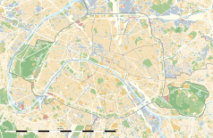
Położenie na mapie Paryża (c) Eric Gaba, Wikimedia Commons user Sting, CC BY-SA 3.0 | ||
| 48,87°N 2,38°E/48,865400 2,376330 | ||
Rue Oberkampf (ulica Oberkampfa) – ulica w 11. dzielnicy Paryża. Nosi imię Christophe-Philippe'a Oberkampfa, francuskiego przemysłowca z XVIII wieku. Znajduje się tu wiele sklepów i restauracji. Potocznie nazwą Oberkampf obejmuje się cały kwartał ulic, jeden z najpopularniejszych w Paryżu celów nocnych zabaw studentów i młodych ludzi.
Media użyte na tej stronie
(c) Eric Gaba, Wikimedia Commons user Sting, CC BY-SA 3.0
Blank land cover map of the city and department of Paris, France, as in January 2012, for geo-location purpose, with distinct boundaries for departments and arrondissements.
Autor: Superbenjamin, Licencja: CC BY-SA 4.0
Blank administrative map of France for geo-location purpose, with regions and departements distinguished. Approximate scale : 1:3,000,000
Autor: Thibault Pelloquin, Licencja: CC BY-SA 3.0
Cette carte représente l'Île de France (en jaune pâle), ses limites départementales et régionales (en traits gris) et ses principaux cours et points d'eau (en bleu). Les départements limitrophes (sont en rose-orange pâle)
Crossroads with a major road ahead.
Autor: Philipp Hertzog, Licencja: CC BY-SA 3.0
very animated rue Oberkampf, Paris 11th Arrondissement


