Obiekty z listy światowego dziedzictwa UNESCO w Ameryce Południowej
Poniżej przedstawiono obiekty z listy światowego dziedzictwa UNESCO, położone w Ameryce Południowej. Obiekty uporządkowano w kolejności alfabetycznej według krajów.
Oznaczenia na liście: P – kryterium przyrodnicze, K – kryterium kulturowe.
Argentyna (11)
 | Park Narodowy Los Glaciares | 1981 | |
 | Misje jezuickie na obszarach zamieszkanych przez Guaranów: San Ignacio Mini, Santa Ana, Nuestra Seora de Loreto i Santa Maria Mayor (Argentyna), ruiny São Miguel das Missões (Brazylia) – wspólnie z Brazylią | 1983 | |
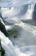
 | Park Narodowy Iguazú | 1984 | |
 | Zespół sztuki naskalnej w Jaskini Rąk (La Cueva de las Manos), Río Pinturas | 1999 | |
 | Półwysep Valdés | 1999 | |
 | Zespół jezuickich obiektów architektonicznych wraz z estancias, Córdoba | 2000 | |
 | Parki Przyrody Ischigualasto-Talampaya | 2000 | |
 | Dolina Quebrada de Humahuaca | 2003 | |
 | Qhapac Ñan – system dróg andyjskich (wspólnie z Boliwią, Chile, Ekwadorem, Kolumbią i Peru) | 2014 | |
 | Architektoniczne dzieła Le Corbusiera, wybitny wkład w ruch modernistyczny (wspólnie z Belgią, Francją, Niemcami, Indiami, Japonią i Szwajcarią) | 2016 | |
 | Park Narodowy Los Alerces | 2017 |
Boliwia (7)
 | Miasto Potosí (zagrożone) | 1987 | |
 | Misje jezuickie na terenie zamieszkanym przez Chiquitos | 1990 | |
(c) I, Anakin, CC-BY-SA-3.0 | Zabytkowe miasto Sucre | 1991 | |
 | Fort Samaipata | 1998 | |
 | Park Narodowy Noel Kempff Mercado | 2000 | |
 | Tiwanaku – ośrodek duchowy i polityczny kultury Tiwanaku | 2000 | |
 | Qhapac Ñan – system dróg andyjskich (wspólnie z Argentyną, Chile, Ekwadorem, Kolumbią i Peru) | 2014 |
Brazylia (23)
 | Zespół zabytkowy w Ouro Preto | 1980 | |
 | Zabytkowe centrum miasta Olinda | 1982 | |
 | Misje jezuickie na obszarach zamieszkanych przez Guaranów: San Ignacio Mini, Santa Ana, Nuestra Seora de Loreto i Santa Maria Mayor (Argentyna), ruiny São Miguel das Missões (Brazylia) – wspólnie z Argentyną | 1983 | |
 | Zabytkowe centrum pierwszej stolicy Brazylii, Salvador da Bahia | 1985 | |
 | Sanktuarium Bom Jesus w Congonhas | 1985 | |
 | Park Narodowy Iguaçu | 1986 | |
 | Nowoczesne miasto Brasilia | 1987 | |
 | Malowidła naskalne w Parku Narodowym Serra da Capivara | 1991 | |
 | Zabytkowe centrum miasta São Luís | 1997 | |
 | Zabytkowe centrum miasta poszukiwaczy diamentów Diamantiny | 1999 | |
 | Południowo-wschodnie rezerwaty puszczy atlantyckiej | 1999 | |
 | Rezerwaty puszczy atlantyckiej na Wybrzeżu Odkryć Geograficznych | 1999 | |
 | Obszar Chroniony Środkowej Amazonki (z Parkiem Narodowym Jaú) | 2000, 2003 | |
| Obszar Chroniony Pantanal | 2000 | ||
 | Region ekologiczny Cerrado: parki narodowe Chapada dos Veadeiros i Emas | 2001 | |
 | Wyspy atlantyckie Brazylii: rezerwaty Fernando de Noronha i Atol das Rocas | 2001 | |
 | Zabytkowe centrum miasta Goiás | 2001 | |
 | Plac São Francisco w mieście São Cristóvão | 2010 | |
 | Rio de Janeiro – krajobrazy carioca pomiędzy górami a morzem | 2012 | |
 | Nowoczesny zespół Pampulha | 2016 | |
 | Stanowisko archeologiczne nabrzeża Cais do Valongo | 2017 | |
 | Paraty i Ilha Grande - kultura i bioróżnorodność | 2019 | |
| Sítio Roberto Burle Marx | 2021 |
Chile (7)
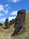
 | Park Narodowy Rapa Nui (Wyspa Wielkanocna) | 1995 | |
 | Kościoły drewniane w Chiloé | 2000 | |
 | Zabytkowa dzielnica miasta portowego Valparaiso | 2003 | |
 | Fabryki saletry Humberstone i Santa Laura | 2005 | |
 | Miasto górnicze Sewell | 2006 | |
 | Qhapac Ñan – system dróg andyjskich (wspólnie z Argentyną, Boliwią, Ekwadorem, Kolumbią i Peru) | 2014 | |
 | Osadnictwo i sztuka mumifikacji kultury Chinchorro w regionie Arica y Parinacota | 2021 |
Ekwador (5)
 | Wyspy Galapagos | 1978, 2001 | |
 | Miasto Quito | 1978 | |
 | Park Narodowy Sangay | 1983 | |
 | Zabytkowe centrum Santa Ana de los Rios de Cuenca | 1999 | |
 | Qhapac Ñan – system dróg andyjskich (wspólnie z Argentyną, Boliwią, Chile, Kolumbią i Peru) | 2014 |
Kolumbia (9)
 | Port, fortece i zespół zabytkowy w Cartagenie | 1984 | |
 | Park Narodowy Los Katios | 1994 | |
 | Zespół zabytkowy w Santa Cruz de Mompox | 1995 | |
 | Narodowy Park Archeologiczny Tierradentro | 1995 | |
 | Park archeologiczny w San Agustín | 1995 | |
 | Rezerwat fauny i flory Malpelo | 2006 | |
 | Krajobraz kulturowy upraw kawy w Kolumbii | 2011 | |
 | Qhapac Ñan – system dróg andyjskich (wspólnie z Argentyną, Boliwią, Chile, Ekwadorem i Peru) | 2014 | |
 | Park Narodowy Chiribiquete – „Maloca jaguara” | 2018 |
Paragwaj (1)
 | Misje jezuickie La Santísima Trinidad de Paraná i Jesús de Tavarangue | 1993 |
Peru (13)
 | Cuzco – pierwsza stolica Imperium Inków oraz Peru | 1983 | |
 | Machu Picchu – miasto z okresu inkaskiego | 1983 | |
 | Stanowisko archeologiczne Chavin | 1985 | |
(c) User:Flothias, CC BY 2.5 | Park Narodowy Huascarán | 1985 | |
 | Strefa archeologiczna Chan Chan (zagrożone) | 1986 | |
 | Park Narodowy Manú | 1987 | |
 | Zespół zabytkowy w Limie | 1988, 1991 | |
 | Park Narodowy Rio Abiseo | 1990, 1992 | |
 | Linie i rysunki naziemne pustyni Nazca i Pampas de Jumana | 1994 | |
 | Stare miasto w Arequipie | 2000 | |
(c) I, KyleThayer, CC-BY-SA-3.0 | Święte miasto Caral-Supe | 2009 | |
 | Qhapac Ñan – system dróg andyjskich (wspólnie z Argentyną, Boliwią, Chile, Ekwadorem i Kolumbią) | 2014 | |
 | Kompleks astronomiczny Chanquillo | 2021 |
Surinam (2)
| Rezerwat przyrody środkowego Surinamu | 2000 | ||
 | Zabytkowe centrum Paramaribo | 2002 |
Urugwaj (3)
(c) I, Fsolda, CC-BY-SA-3.0 | Zabytkowa dzielnica miasta Colonia del Sacramento | 1995 | |
 | Krajobraz kulturowo-przemysłowy Fray Bentos | 2015 | |
 | Prace inżyniera Eladio Dieste – Iglesia de Cristo Obrero y Nuestra Señora de Lourdes | 2021 |
Wenezuela (3)
 | Coro i jego port (zagrożone) | 1993 | |
| Park Narodowy Canaima | 1994 | ||
 | Miasto uniwersyteckie Ciudad Universitaria de Caracas | 2000 |
Media użyte na tej stronie
Autor: Ministério da Cultura, Licencja: CC BY 2.0
Crédito: Anderson Schneider/IPHAN
Autor: Reinhard Jahn, Mannnnnheim, Licencja: CC BY-SA 2.0 de
Iguazu Falls, in Misiones (Argentina).
Ilha Grande, Rio de Janeiro, Brasilien
Autor: de Gerd Breitenbach, Licencja: CC-BY-SA-3.0
Maranon River between Chachapoyas (Leymebamba) and Celendin
Autor: Caracas1830, Licencja: CC BY 3.0
Mural by Mateo Manaure, Main Library, Central University of Venezuela
Autor:
Valdes Peninsula, Patagonia (Argentina).
Autor: Fulsen z niemieckiej Wikipedii, Licencja: CC-BY-SA-3.0
Photo of statue “el Fraile” (the monk) in Tiwanaku.
Autor: rewbs.soal, Licencja: CC BY-SA 2.0
Old factory buildings in the abandoned city of Humberstone, Chile
Autor: Christof Berger, Licencja: CC-BY-SA-3.0
Perito Moreno Glacier, in Los Glaciares National Park, southern Argentina
Hands at the Cuevas de las Manos upon Río Pinturas, near the town of Perito Moreno in Santa Cruz Province, Argentina. Picture taken by me in 2005.
Autor: Kyle Simourd, Licencja: CC BY 2.0
Valparaiso's port and the city
Autor: Roberto Garrido from Salvador, Brasil, Licencja: CC BY 2.0
Dois Irmãos - Fernando de Noronha, Brazil.
Autor: Carmeladgl, Licencja: CC BY-SA 4.0
This is a photo of a monument in Brazil identified by the ID
Autor: Nicolas Barriola, Licencja: CC BY-SA 3.0
This is a photo of a Uruguayan monument identified by the ID
Autor: Mario Carvajal, Licencja: CC BY 2.0
Tomb with deity. Warriers with alter ego serve as pillars for the tomb
The Negro River flowing through the eastern edge of Brazil’s Jau National Park. The river is the big strip of blue running from left to right across the image, and the other blue ribbons are tributaries. Originating at the border of Venezuela and Brazil, the Negro River meets up with the Amazon in central Brazil to become its largest tributary. Half-submerged islands can be seen in the center of the river. Between November and April when the river is at its peak, many of these islands disappear.
Autor: Carlos Castaño Uribe, Licencja: CC BY-SA 3.0
A tepui within the en:Parque Nacional Natural Chiribiquete
Rua Portugal, mercado central, bairro Praia Grande, São Luis do Maranhão
Autor: inyucho, Licencja: CC BY 2.0
Tumba Tierradentro. Colombia
Tombs in Tierra Dentro
Description=El Fuerte, sitio pre-columbian cerca de Samaipata, Bolivia Source=own work Date=2006-8-10 Author=Franz Barjak
Permission=own work, public domainOuro Preto, Minas Gerais, Brasilien
Autor: Vitor 1234, Licencja: CC BY-SA 3.0
Painting of two animals. This painting is considered the symbol of the park.
Autor: Artyominc, Licencja: CC BY-SA 3.0
Christ the Redeemer overlooking Rio De Janeiro
Old area of Fray Bentos Meat Factory
Autor: Halley Pacheco de Oliveira, Licencja: CC BY-SA 3.0
Cais da Imperatriz, construído para receber Teresa Cristina quando veio se casar com Dom Pedro II, e o Cais do Valongo, considerado o maior porto de escravos das Américas do Séc XIX. (ACRJ)
Autor: Colegota, Licencja: CC BY-SA 2.5 es
Inca trail from Cusco to Machu Picchu in Perú. Day 2. Ascent to Warmiwanusca or Dead Woman's Pass, which, at 4,200 m above sea level, is the highest point on the trail.
Autor: Oryginalnym przesyłającym był As578 z angielskiej Wikipedii, Licencja: CC BY-SA 2.5
View of en:Ischigualasto National Park in the province of San Juan, Argentina.
Autor: Rojk, Licencja: CC-BY-SA-3.0
cataratas Arcoiris (80 m.) en el parque Nacional Noel Kempff Mercado (Bolivia).
Autor: O--o, Licencja: CC BY 3.0
Santa Cruz de Mompox Chiesa di Santa Barbara, con il caratteristico campanile sul balcone
Autor: Autor nie został podany w rozpoznawalny automatycznie sposób. Założono, że to Nateirma~commonswiki (w oparciu o szablon praw autorskich)., Licencja: CC-BY-SA-3.0
View of Machu Picchu with terrce like steps.
Autor: Magui, Licencja: CC BY-SA 4.0
Lago Menéndez desde cerca de Puerto Chucao, al fondo el cerro Torrecillas y su glaciar.
Autor: David Edgar, Licencja: CC BY-SA 3.0
The "Thirteen Towers" of Chanquillo, Ancash, Peru, taken from the Chanquillo fortress (on the top of a neighbouring hill in the desert).
Autor: Pablo Trincado, Licencja: CC BY 2.0
Head of a mummy from the Chinchorro culture, found in Northern Chile.
Autor: putneymark, Licencja: CC BY-SA 2.0
Iglesia de la Compania, Quito
Autor: Triángulo del Café Travel, Licencja: CC BY 2.0
Cafetales,Triángulo del Café, Colombia
Autor: Alexandre Machado[2], Licencja: CC BY-SA 2.0
Sanctuary of Bom Jesus do Congonhas
This true-color image of the Galapagos Islands was acquired on March 12, 2002, by the Moderate-resolution Imaging Spectroradiometer (MODIS), flying aboard NASA's Terra satellite. The Galapagos Islands, which are part of Ecuador, sit in the Pacific Ocean about 1000 km (620 miles) west of South America. As the three craters on the largest island (Isabela Island) suggest, the archipelago was created by volcanic eruptions, which took place millions of years ago.
Barroc church in Pelourinho
Autor: unknown, Licencja: CC-BY-SA-3.0
Autor: Daniel Souza Lima, Licencja: CC BY-SA 3.0
Foto feita no final da trilha em direção ao mar, após 1.700 metros de caminhada e 536 metros de altitude, no topo do Monte Pascoal.
Bailey bridge over Coppename river, Suriname. Constructed 1976, photograph December 2002.
Autor: Heretiq, Licencja: CC BY-SA 4.0
Ruins of the church entrance in the San Ignacio Miní monastery, Argentina
Autor: Danielsantiago9128, Licencja: CC BY-SA 3.0
This is a photo of an Argentine monument identified by the ID
(c) I, Anakin, CC-BY-SA-3.0
Casa de la libertad (Maison de la liberté) dans la capitale de la Bolivie : Sucre. C'est ici que fut signé le traité d'indépendance de la Bolivie. Traité qui fut écrit par Simón Bolívar.
Autor: Pedro Rebolledo Rubilar (Pedrebol), Licencja: CC BY 2.5
Iglesia de Achao, capital de Quinchao
Autor: Bamse, Licencja: CC BY-SA 3.0
Church of Concepción, Santa Cruz, Bolivia. Part of the Jesuit Missions of the Chiquitos World Heritage Site.
Autor: BjarteSorensen, Licencja: CC-BY-SA-3.0
Drawing of a colibri in the desert outside Nazca
Autor: As578, Licencja: CC BY-SA 2.5
View of riverbank in Manu National Park, Madre de Dios, Peru
Vista aérea da Esplanada dos Ministérios
(c) Alicia Yo z angielskojęzycznej Wikipedii, CC-BY-SA-3.0
The Pantanal - a Flooded grasslands and savannas ecoregion of south-central South America.
Autor: Morio, Licencja: CC-BY-SA-3.0
View of Ouro Preto
- Left end-near side: Igreja da Conceução(left side)
- Left end-center: Igreja das Mercês e Perdões(rear view)
- Center: Igreja de São Francisco de Assis
- right: Museu da Inconfidência(has one belfry), the state public office building of Minas Gerais before
- right end: Igreja do Carmo(rear view, and has two belfries)
Mountains (Serra dos Órgaos) at the entrance of Teresópolis, Brazil
Autor: Sharon odb, Licencja: CC-BY-SA-3.0
Monumento Arqueológico Chavín de Huántar. In 2006 I spent 4 months in the town of Chavín de Huántar for anthropological research on tourism. I made this picture during one of my numerous visits to the ruins.
Potosi as seen from paraglider
Autor: Kevstan, Licencja: CC BY-SA 3.0
Fishnet walls of storeroom area of the Tschudi complex part of the Chimu site Chan Chan near Trujillo, Peru
Malpelo Island, Colombia
Autor: Leofleck z angielskiej Wikipedii, Licencja: CC-BY-SA-3.0
Chapada dos Veadeiros National Park
ラ・サンティシマ・トリニダー・デ・パラナのイエズス会伝道所跡(パラグアイ)
Fotografía del Río Atrato en Colombia desde helicóptero.


.JPG/125px-ラ・サンティシマ・トリニダー・デ・パラナ(パラグアイ).JPG)


