Obiekty z listy światowego dziedzictwa UNESCO w Australii i Oceanii
Poniżej przedstawiono obiekty z listy światowego dziedzictwa UNESCO, położone w Australii i Oceanii. Listę uporządkowano w kolejności alfabetycznej według krajów.
Oznaczenia na liście: P – kryterium przyrodnicze, K – kryterium kulturowe.
Australia (20)
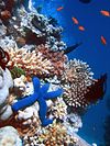
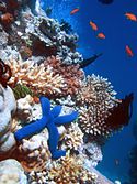
Copyright (c) 2004 Richard Ling, CC-BY-SA-3.0 | Wielka Rafa Koralowa | 1981 | |
 | Park Narodowy Kakadu | 1981 | |
 | Region Wyschniętych Jezior Willandra | 1981 | |
 | Tasmanian Wilderness[a] | 1982, 1989 | |
 | Wyspy Lorda Howe | 1982 | |
 | Środkowo-Wschodni Rezerwat Lasów Deszczowych[b] | 1986, 1988, 1994 | |
 | Park Narodowy Uluru-Kata Tjuta; zob. też Uluru i Kata Tjuta | 1987 | |
 | Wet Tropics of Queensland | 1988 | |
(c) Photographs by JarrahTree...commons.wikimedia.org, CC BY 2.5 au | Zatoka Rekina w Australii Zachodniej | 1991 | |
 | Wielka Wyspa Piaszczysta | 1992 | |
 | Zespoły skamielin ssaków australijskich Riversleigh/Naracoorte | 1994 | |
 | Wyspy Heard i McDonalda | 1997 | |
 | Macquarie | 1997 | |
 | Park Narodowy Gór Błękitnych | 2000 | |
| Park Narodowy Purnululu | 2003 | ||
 | Budynek Wystawy Królewskiej i Carlton Gardens w Melbourne | 2004 | |
 | Opera w Sydney | 2007 | |
 | Australijskie miejsca zesłańców | 2010 | |
 | Ningaloo Coast | 2011 | |
| Krajobraz kulturowy Budj Bim | 2019 |
Fidżi (1)
(c) I, Anton Leddin, CC-BY-SA-3.0 | Historyczne miasto portowe Levuka | 2013 |
Kiribati (1)
 | Obszar chroniony wysp Feniks | 2010 |
Mikronezja (1)
 | Nan Madol – ośrodek ceremonialny wschodniej Mikronezji (zagrożony) | 2016 |
Nowa Kaledonia (francuskie terytorium zależne)
Nowa Zelandia (3)
(c) David Briody, CC BY 2.0 | Rezerwat przyrody Te Wahipounamu | 1990 | |
 | Park Narodowy Tongariro | 1990, 1993 | |
 | Nowozelandzkie Wyspy Subantarktyczne | 1990, 1993 |
Palau (1)
 | Rock Islands Southern Lagoon | 2012 |
Papua-Nowa Gwinea (1)
 | Wczesne stanowisko rolnicze Kuk | 2008 |
Pitcairn (kolonia brytyjska)
Polinezja Francuska (francuskie terytorium zależne)
Vanuatu (1)
 | Dominium wodza Roi Maty | 2008 |
Wyspy Marshalla (1)
 | Atol Bikini | 2010 |
Wyspy Salomona (1)
 | Region East Rennell na wyspie Rennell (zagrożony) | 1998 |
Uwagi
- ↑ Parki narodowe zachodniej Tasmanii.
- ↑ Centaral Eastern Rainforest Reserves na granicy Nowej Południowej Walii oraz Queensland.
Media użyte na tej stronie
Autor: unknown, Licencja: CC-BY-SA-3.0
Góry Błękitne (Blue Mountains) w Australii
Autor: Original uploader was Aquaimages at en.wikipedia, Licencja: CC BY-SA 2.5
One of the many Rock Islands, Palau Islands, Micronesia. Image taken by Clark Anderson/Aquaimages.
Nan Madol
Autor: User:Diliff, Licencja: CC BY-SA 2.5
A typical tropical rainforest scene in Daintree National Park
Autor: Hullwarren, Licencja: CC BY-SA 3.0
East coast beach - Macquarie Island
The Kuk Early Agricultural Site consists of 116 ha of swamps in the western highlands of New Guinea 1,500 meters above sea-level. Archaeological excavation has revealed the landscape to be one of wetland reclamation worked almost continuously for 7,000, and possibly for 10,000 years. The area was declared a UNESCO World Heritage Site in 2008. The image was acquired May 7, 2002, covers an area of 31.6 x 40 km, and is located at 5.8° S, 144.3° E.
Autor: David Morgan-Mar, Licencja: CC BY 2.5
Lord Howe Island, showing Mts Lidgbird and Gower, taken from Kim's Lookout.
Tatiman Passage in the northwest of the Atoll is the only navigable entrance into the lagoon of Nikumaroro (formerly Gardner Island), Phoenix Islands, Kiribati. Original field notes: Showing tree heliotrope (far right). All mounded vegetation on atolls is native. The introduced, most important food plant, coconut palm, tends to have a tall, spiky look. Many inter-islet channels are not as deep as this one.
Autor:
This Image was created by User:Amog.
|
The Sydney Opera Houseshot in September 2007
(c) Photographs by JarrahTree...commons.wikimedia.org, CC BY 2.5 au
Steep Point the most western point of the Shark Bay area, in Western Australia - taken from the aeroplane flying south towards Perth, Western Australia, in November 2007
Heard Island
Autor: Photograph taken by Diliff and straightened by Ian Fieggen, Licencja: CC BY 2.5
A view of the south-facing side of the Royal Exhibition Building in Melbourne, Australia. It was built in 1880 and is the first building to be given a World Heritage Site listing in Australia. This image was taken with a Canon 5D and 17-40mm f/4L lens on 13th of October, 2005.
(c) Peter Ruckstuhl, CC-BY-SA-3.0
Purnululu_National_Park
(c) David Briody, CC BY 2.0
Northern end of Lake Pukaki in front of Burnett Mountains. The valley of Jollie River is in the center of the picture; Tasman Valley leads to the left out of the picture.
Fraser Island from the Indian Head
Copyright (c) 2004 Richard Ling, CC-BY-SA-3.0
A Blue Starfish (Linckia laevigata) resting on hard Acropora and Porites corals (one can also see Anthiinae fish and crinoids). Lighthouse, Ribbon Reefs, Great Barrier Reef.
Cradle Mountain, Tasmania, Australia
Autor: Oryginalnym przesyłającym był J Bar z angielskiej Wikipedii, Licencja: CC-BY-SA-3.0
Hyde Park Barracks, Macquarie Street, Sydney, Australia. I took this photo on the 1st September 2006. J Bar 01:18, 4 September 2006 (UTC)
Scanned photo of Campbell Island landscape.
Autor: Phillip Capper from Wellington, New Zealand, Licencja: CC BY 2.0
Cave drawings in Fels Cave, Lelepa Island. Dated at about 900AD, but otherwise mysterious. In June 2008 this site and the neighbouring sites associated with the king Roi Mata, were designated as a UNESCO World Heritage site
A skeleton of a Marsupial Lion (Thylacoleo carnifex) in the Victoria Fossil Cave, Naracoorte Caves National Park


