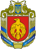
Obwód kirowohradzki
| Obwód | |||||
| |||||
| Państwo | |||||
|---|---|---|---|---|---|
| Siedziba | |||||
| Kod ISO 3166-2 | UA-35 | ||||
| Gubernator | Andrij Nazarenko | ||||
| Powierzchnia | 24 588 km² | ||||
| Populacja (2021) • liczba ludności |
| ||||
| Szczegółowy podział administracyjny | |||||
| Liczba rejonów | 4 | ||||
Położenie na mapie | |||||
| Portal | |||||
Obwód kirowohradzki (ukr. Кіровоградська область) – jeden z 24 obwodów Ukrainy. Leży w środkowej części Ukrainy, nad Dnieprem. Stolicą obwodu jest Kropywnycki.
Obwód na północy graniczy z obwodem połtawskim, na wschodzie i południowym wschodzie z dniepropietrowskim, na południu z mikołajowskim i odeskim, na zachodzie z winnickim.
Obwód w większości leży na terenie historycznej Ukrainy Prawobrzeżnej i Zaporoża. Zachodnie krańce leżą w granicach Podola.
Demografia
Skład narodowościowy obwodu w 2001 roku[2]:
- Ukraińcy: 1014,6 tys. (90,1%)
- Rosjanie: 83,9 tys. (7,5%)
- Mołdawianie: 8,2 tys. (0,7%)
- Białorusini: 5,5 tys. (0,5%)
- Węgrzy: 2,9 tys. (0,3%)
- Bułgarzy: 2,2 tys. (0,2%)
- Żydzi: 1,1 tys. (0,1%)
Historia
Historyczna przynależność administracyjna obszaru:
- 1566–1569:
 Wielkie Księstwo Litewskie: województwo kijowskie, województwo bracławskie
 - 1569–1667:
 Korona Królestwa Polskiego, prowincja małopolska: województwo kijowskie, województwo bracławskie
 - 1667–1672:
 Carstwo Rosyjskie/
 Korona Królestwa Polskiego, prowincja małopolska: województwo kijowskie, województwo bracławskie
 - 1672–1699:
 Carstwo Rosyjskie/
 Imperium Osmańskie/
 Korona Królestwa Polskiego, prowincja małopolska: województwo kijowskie
 - 1699–1721:
 Carstwo Rosyjskie/
 Korona Królestwa Polskiego, prowincja małopolska: województwo kijowskie, województwo bracławskie
 - 1721–1754:
 Imperium Rosyjskie/
 Korona Królestwa Polskiego, prowincja małopolska: województwo kijowskie, województwo bracławskie
 - 1754–1764:
 Imperium Rosyjskie: Nowa Serbia, Nowosłobodzki Pułk Kozacki/
 Korona Królestwa Polskiego, prowincja małopolska: województwo kijowskie, województwo bracławskie
 - 1764–1783:
 Imperium Rosyjskie: gubernia noworosyjska/
 Korona Królestwa Polskiego, prowincja małopolska: województwo kijowskie, województwo bracławskie
 - 1783–1793:
 Imperium Rosyjskie/
 Korona Królestwa Polskiego, prowincja małopolska: województwo kijowskie, województwo bracławskie
 - 1793–1796:
 Imperium Rosyjskie
 - 1796–1803:
 Imperium Rosyjskie: gubernia noworosyjska, gubernia kijowska, gubernia podolska
 - 1803–1917:
 Imperium Rosyjskie: gubernia chersońska, gubernia kijowska, gubernia podolska
 - 1920–1922:
 Ukraińska SRR
 - 1922–1991:
 ZSRR: Ukraińska SRR
 - od 1991:
 Ukraina: obwód kirowohradzki
Największe miasta
- Kropywnycki
- Aleksandria
- Switłowodsk
- Znamianka
- Dołyńska
- Nowoukrainka
- Hajworon
- Nowomyrhorod
- Mała Wyska
- Bobryniec
- Pomiczna
- Błahowiszczenśke
Przypisy
- ↑ Чисельність наявного населення України на 1 січня 2021 року [dostęp 2021-07-31] (ukr.).
- ↑ Всеукраїнський перепис населення 2001 | English version | Results | General results of the census | National composition of population | Kirovohrad re..., 2001.ukrcensus.gov.ua [dostęp 2017-11-25].
Linki zewnętrzne
Media użyte na tej stronie
Autor: Amakuha, Licencja: CC BY-SA 3.0
Blank map of Ukraine with oblasts in 4 colors. It's based on my map Map of Ukraine Oblasts simple DEMO.svg, which is based on Map of Ukraine political simple blank.svg. It's easy to edit.
Autor: Osipov Georgiy Nokka, Licencja: CC BY-SA 3.0
Предполагаемый проект рисунка флага корабля "Орёл"
Autor: Alex Tora, Licencja: CC BY 3.0
Flags of Ruthenian lands in the battle of Tannenberg, 1410.
Flag of the Kirovohrad Oblast, Ukraine. Colors are crimson (#DC143C) and gold (#FFD700).
Banner of Kingdom of Poland in the 14th century
A seal of Duke Premislaus II from 1290 shows the ruler holding a banner emblazoned with a crowned eagle. During the reign of King Ladislaus (r. 1320–1333), the red cloth with the White Eagle was established as the royal banner. The orientation of the eagle on the banner varied; its head could point either upwards or towards the hoist.
Autor: Nataliya Shestakova, Licencja: CC BY-SA 4.0
To jest zdjęcie miejsca lub budynku wpisanego do Państwowego Rejestru Zabytków Nieruchomych Ukrainy pod numerem: 35-101-0306
Флаг Украинской Советской Социалистической Республики (1919-1929 гг.)
Flag of the Ottoman Empire (c. 1750s).[1]
A variety of Ottoman naval flags with crescents are recorded in Western sources during the 18th century.
Flaggen aller seefahrenden Nationen shows several Turkish naval flags with three crescents (heraldic decrescents, horns pointing away from the hoist as in the later Ottoman flag)Coat of arms of Kirovohrad Oblast, Ukraine
Autor: Sven Teschke, Licencja: CC-BY-SA-3.0
Political map of Ukraine, highlighting Kirovograd Oblast
Coat of arms of Kirovohrad Oblast, Ukraine


