Ocotal
| |||||
 | |||||
| Państwo | |||||
|---|---|---|---|---|---|
| Departament | Nueva Segovia | ||||
| Wysokość | 85,23 m n.p.m. | ||||
| Populacja (2010) • liczba ludności | 39 000[1] | ||||
| Kod pocztowy | 37000 | ||||
| Strona internetowa | |||||
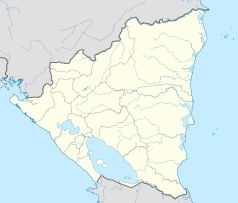
Ocotal - miasto w północnej Nikaragui, położone około 20 km na południe od granicy z Hondurasem, w odległości około 225 km od stolicy kraju Managui. Miasto leży na wysokości 590 m n.p.m., w dolinie rzeki Coco. Współrzędne geograficzne: 13°37′51″N 86°28′51″W/13,630833 -86,480833. Ośrodek administracyjny departamentu Nueva Segovia. Ludność: 39 tys. (2010).
Miasto zostało założone w 1780 jako Nueva Reducción de Segovia.
Gospodarka miasta opiera się na uprawie kawy i tytoniu. Ponadto w mieście rozwinął się przemysł obuwniczy oraz meblarski[1].
Miasta partnerskie
Przypisy
- ↑ a b Ocotal, [w:] Encyklopedia PWN [online] [dostęp 2021-08-02].
Media użyte na tej stronie
The flag of Navassa Island is simply the United States flag. It does not have a "local" flag or "unofficial" flag; it is an uninhabited island. The version with a profile view was based on Flags of the World and as a fictional design has no status warranting a place on any Wiki. It was made up by a random person with no connection to the island, it has never flown on the island, and it has never received any sort of recognition or validation by any authority. The person quoted on that page has no authority to bestow a flag, "unofficial" or otherwise, on the island.
Autor: Alexrk2, Licencja: CC BY-SA 3.0
Location map of Nicaragua with Departamentos, Equirectangular projection, N/S stretching 100 %. Geographic limits of the map:


