Ocotlán
 | |||
| |||
| Państwo | |||
|---|---|---|---|
| Stan | |||
| Gmina | Ocotlán | ||
| Data założenia | 15 marca 1537 | ||
| Burmistrz | Juan Manuel Alatorre Franco PRI | ||
| Powierzchnia | 497,82 km² | ||
| Wysokość | 1533[1] m n.p.m. | ||
| Populacja (2010) • liczba ludności • gęstość |
| ||
| Kod pocztowy | 47800[3] | ||
| Strona internetowa | |||
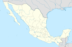
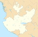
Ocotlán – miasto w Meksyku, w stanie Jalisco, nad jeziorem Chapala. Jest siedzibą władz gminy Ocotlán[4]. Miasto w 2010 r. zamieszkiwało ponad 90 000 osób. W mieście rozwinął się przemysł spożywczy.
Współpraca
 Olathe, Stany Zjednoczone
 Greenville, Stany Zjednoczone
 Oxnard, Stany Zjednoczone
 Stone Park, Stany Zjednoczone
Zobacz też
Przypisy
- ↑ DB City - Ocotlán (ang.). [dostęp 2012-08-17].
- ↑ Poblacón total por municipio 2010 (Meksykański Urząd Statystyczny - INEGI) (hiszp.). [dostęp 2012-08-17].
- ↑ Codigo potales - Jalisco (hiszp.). [dostęp 2012-08-17].
- ↑ Enciclopedia de los Municipios de México. Jalisco – Ocotlán (hiszp.). inafed.gob.mx. [dostęp 2015-09-10].
Media użyte na tej stronie
The flag of Navassa Island is simply the United States flag. It does not have a "local" flag or "unofficial" flag; it is an uninhabited island. The version with a profile view was based on Flags of the World and as a fictional design has no status warranting a place on any Wiki. It was made up by a random person with no connection to the island, it has never flown on the island, and it has never received any sort of recognition or validation by any authority. The person quoted on that page has no authority to bestow a flag, "unofficial" or otherwise, on the island.
Autor: Bambirucho, Licencja: CC BY-SA 4.0
Main (I think) church in Ocotlán Jalisco
Location Map of Jalisco. EPSG:3857 projection, Geographic limits of the map:
- N: 23.00° N
- S: 18.60° N
- W: 106.00° W
- E: 101.20° W


