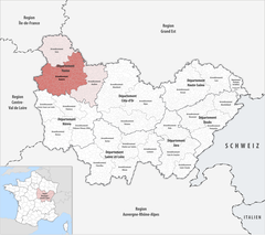
Okręg Auxerre
| Okręg | |
 | |
| Państwo | |
|---|---|
| Siedziba | Auxerre |
| Powierzchnia | 3515 km² |
| Populacja • liczba ludności | 178 743 |
| • gęstość | 51 os./km² |
Położenie na mapie | |
| Portal | |
Okręg Auxerre (fr. Arrondissement d'Auxerre) – okręg we wschodniej Francji. Populacja wynosi 179 tysięcy.
Podział administracyjny
W skład okręgu wchodzą następujące kantony:
- Aillant-sur-Tholon,
- Auxerre-Est,
- Auxerre-Nord,
- Auxerre-Nord-Ouest,
- Auxerre-Sud,
- Auxerre-Sud-Ouest,
- Bléneau,
- Brienon-sur-Armançon,
- Chablis,
- Charny,
- Coulanges-la-Vineuse,
- Coulanges-sur-Yonne,
- Courson-les-Carrières,
- Joigny,
- Ligny-le-Châtel,
- Migennes,
- Saint-Fargeau,
- Saint-Florentin,
- Saint-Sauveur-en-Puisaye,
- Seignelay,
- Toucy,
- Vermenton.
Media użyte na tej stronie
BlasonBourgogneFrancheComté.svg
Autor: Superbenjamin, Licencja: CC BY-SA 4.0
Blason de Bourgogne-Franche-Comté
Autor: Superbenjamin, Licencja: CC BY-SA 4.0
Blason de Bourgogne-Franche-Comté
Arrondissement d Auxerre.PNG
Maps of arrondissements and cantons of France: Arrondissement d Auxerre.PNG (Région Bourgogne)
Maps of arrondissements and cantons of France: Arrondissement d Auxerre.PNG (Région Bourgogne)
Locator map of Arrondissement Auxerre 2019.png
Autor: Tschubby, Licencja: CC-BY-SA-3.0
Lage des Arrondissements Auxerre
Autor: Tschubby, Licencja: CC-BY-SA-3.0
Lage des Arrondissements Auxerre


