Okupuj Wall Street
 Okupuj Wall Street, 14. dzień protestu | |
| Państwo | |
|---|---|
| Początek wystąpień | 17 września 2011 |
| Charakter wystąpień | demonstracje, sit-in |
| 40°42′33″N 74°00′40″W/40,709167 -74,011111 | |
Okupuj Wall Street (ang. Occupy Wall Street) – seria demonstracji o charakterze okupacyjnym, rozpoczętych 17 września 2011 roku w Zuccotti Park w Nowym Jorku. Protesty zostały zainicjowane m.in. przez kanadyjską grupę aktywistów z organizacji AdBusters[1][2].
Uczestnicy, nazywający siebie „99 procentami” (ang. „99 percenters”)[3], protestowali głównie przeciwko nierównościom społecznym, chciwości korporacji, banków oraz przeciwko nadmiernemu wpływowi bankierów, menedżerów wielkich korporacji i lobbystów na rząd[4][5][6].
Przypisy
- ↑ Adbusters sparks Wall Street protest. The Vancouver Courier. [dostęp 2011-10-16]. [zarchiwizowane z tego adresu (2012-08-30)]. (ang.).
- ↑ Adbusters – About. Adbusters.org. [dostęp 2011-10-16]. [zarchiwizowane z tego adresu (2011-10-31)]. (ang.).
- ↑ 99 Percenters and 53 Percenters Face Off. The New York Times – Business Day – Economix. [dostęp 2011-10-16]. (ang.).
- ↑ Wall Street protesters: We're in for the long haul. Bloomberg Businessweek. [dostęp 2011-10-16]. (ang.).
- ↑ #OccupyWallSt, Then #OccupyKSt, Then #OccupyMainSt. Lawrence Lessig, The Huffington Post. [dostęp 2011-10-16]. (ang.).
- ↑ Occupy America: protests against Wall Street and inequality hit 70 cities. The Guardian. [dostęp 2011-10-16]. (ang.).
Linki zewnętrzne
Media użyte na tej stronie
Autor: Uwe Dedering, Licencja: CC BY-SA 3.0
Location map of the USA (without Hawaii and Alaska).
EquiDistantConicProjection:
Central parallel:
* N: 37.0° N
Central meridian:
* E: 96.0° W
Standard parallels:
* 1: 32.0° N
* 2: 42.0° N
Made with Natural Earth. Free vector and raster map data @ naturalearthdata.com.
Formulas for x and y:
x = 50.0 + 124.03149777329222 * ((1.9694462586094064-({{{2}}}* pi / 180))
      * sin(0.6010514667026994 * ({{{3}}} + 96) * pi / 180))
y = 50.0 + 1.6155950752393982 * 124.03149777329222 * 0.02613325650382181
      - 1.6155950752393982  * 124.03149777329222 *
     (1.3236744353715044  - (1.9694462586094064-({{{2}}}* pi / 180))
      * cos(0.6010514667026994 * ({{{3}}} + 96) * pi / 180))
The flag of Navassa Island is simply the United States flag. It does not have a "local" flag or "unofficial" flag; it is an uninhabited island. The version with a profile view was based on Flags of the World and as a fictional design has no status warranting a place on any Wiki. It was made up by a random person with no connection to the island, it has never flown on the island, and it has never received any sort of recognition or validation by any authority. The person quoted on that page has no authority to bestow a flag, "unofficial" or otherwise, on the island.
Autor: Zenhaus, Licencja: CC BY-SA 3.0
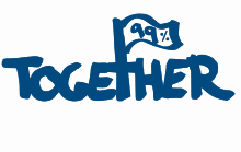
Occupy Wall Street Together. We are 99%. Poster.
Autor: David Shankbone , Licencja: CC BY 3.0
Friday, Day 14 of w:Occupy Wall Street - photos from the camp in Zuccotti Park


